• Photos
    • InChrome
    • Crosslands
    • Monolithical
    • Anthropics
    • TeleKinetic
    • ConKinetic
  • Essays
    • Blog
    • Terratory
  • Info
    • About
    • Contact
Ryan Nemeth / Landscape Photographer
  • Photos
    • InChrome
    • Crosslands
    • Monolithical
    • Anthropics
    • TeleKinetic
    • ConKinetic
  • Essays
    • Blog
    • Terratory
  • Info
    • About
    • Contact

EDGELAND SPACE: Jennifer Colten

7.Encounter.21.0006.jpg 3.8457.jpg 8.1500.Wasteland-Ecology.0004.jpg 12.Field-Note.9599.jpg 9.AB.0754.jpg 14.Encounter.2286.jpg 10.1500.Draped-Electric-Wire.5180.jpg 11.Encounter.43.5220.jpg 6.Encounter.2487.jpg 15.Encounter.48.0834.jpg

Images by: Jennifer Colten

Written by: Ryan Nemeth

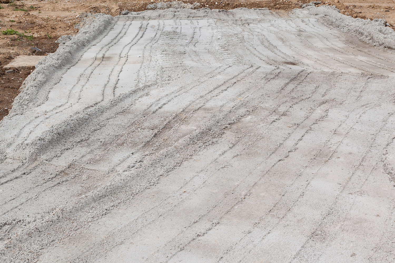
Many of us assume that the spaces within our city’s boundaries naturally fit together like pieces of a puzzle. Thus, it is easy for us to assume that all of the lands within the defined boundaries of our cities have been assigned productive functions. This is especially true when we think of urban environments in context to a grid system and highly developed city-zoning ordinances. However, having neat and orderly areas within our urban centers does not necessarily mean that cities behave in a predictable fashion. In fact, something both unremarkable and unruly often exists when land use ordinances collide within the urban core. Overlapping land designations and competing functional interests often create dead zones or tracts of land with confused and unassigned values. Yet, these indifferent spaces are inevitably much more complicated than this simple assessment. The reality is that our cities have many inactive patches of land that fall out of favor with humans for many reasons.

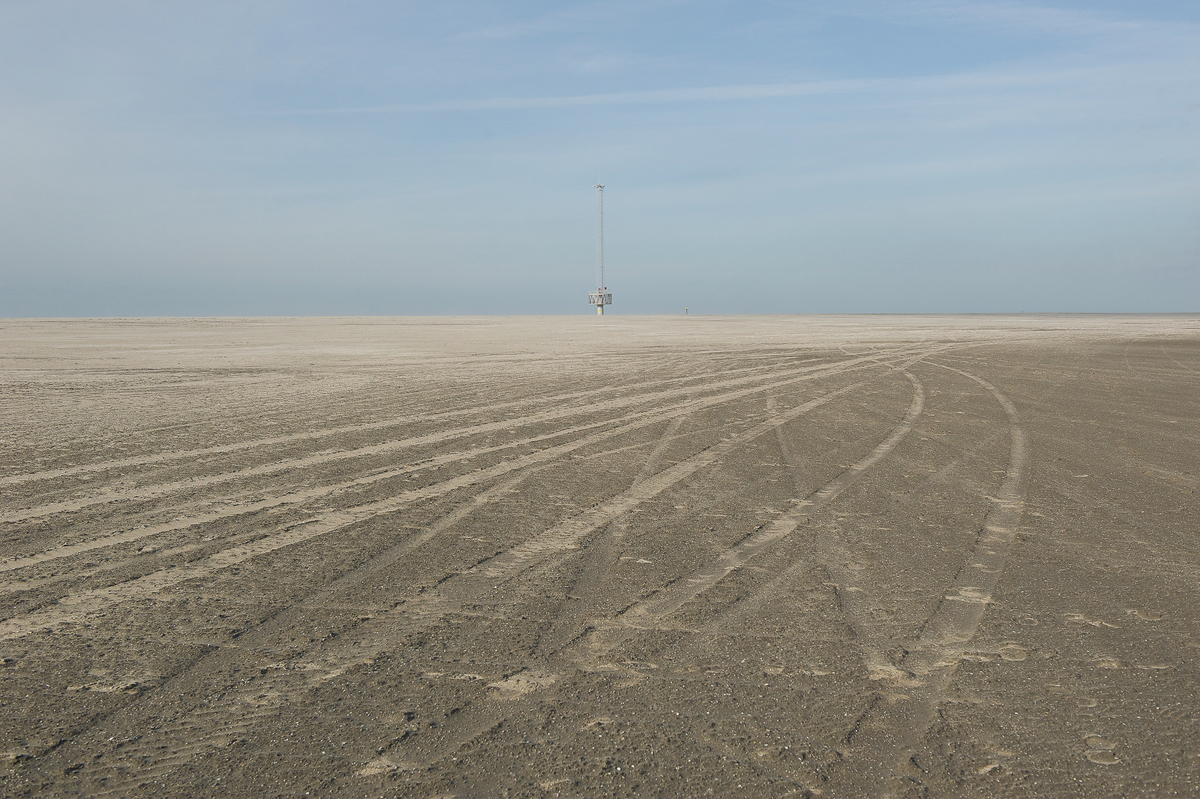
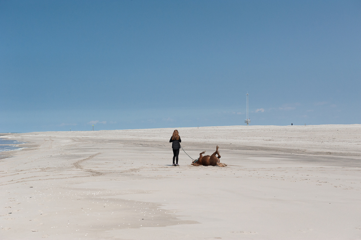
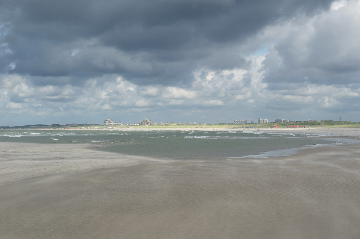
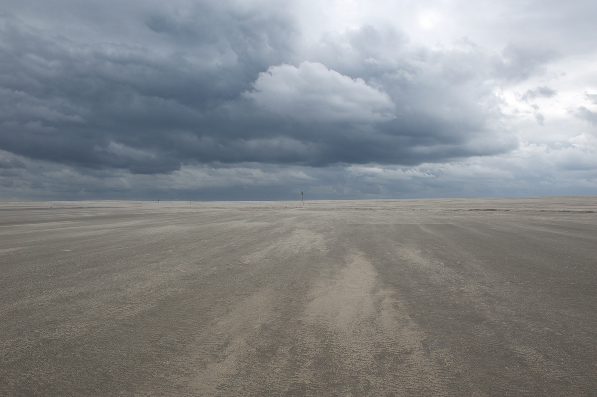
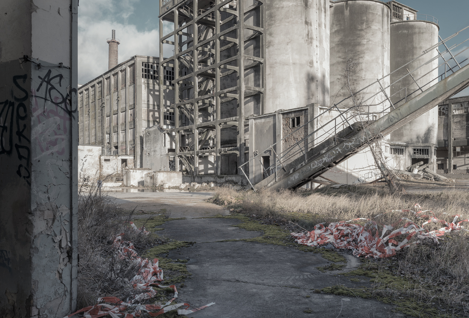
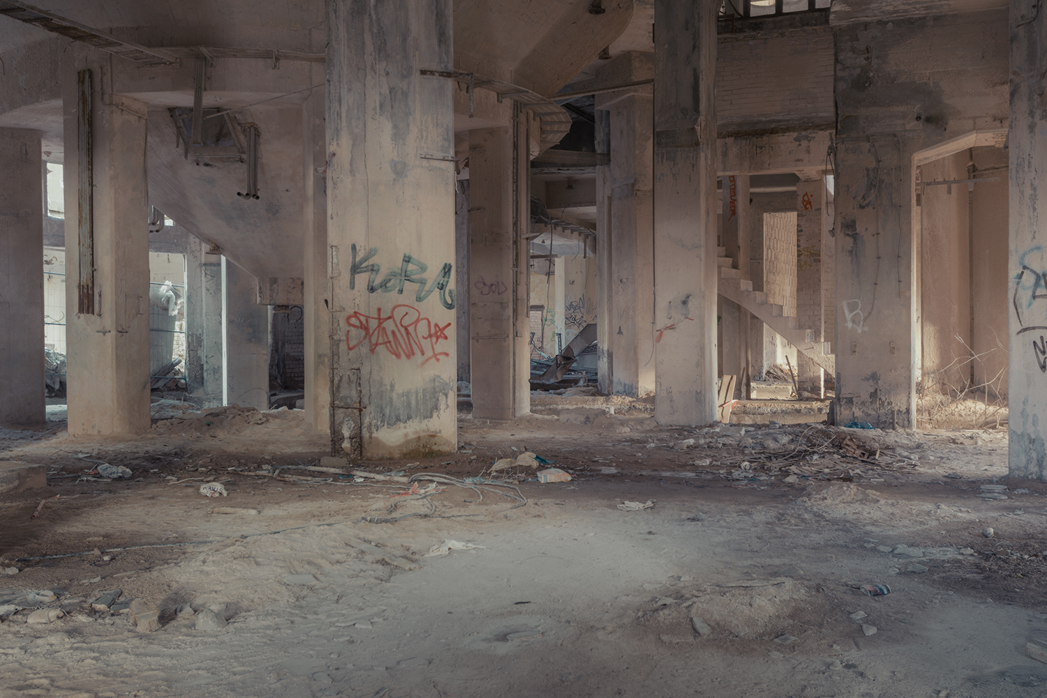
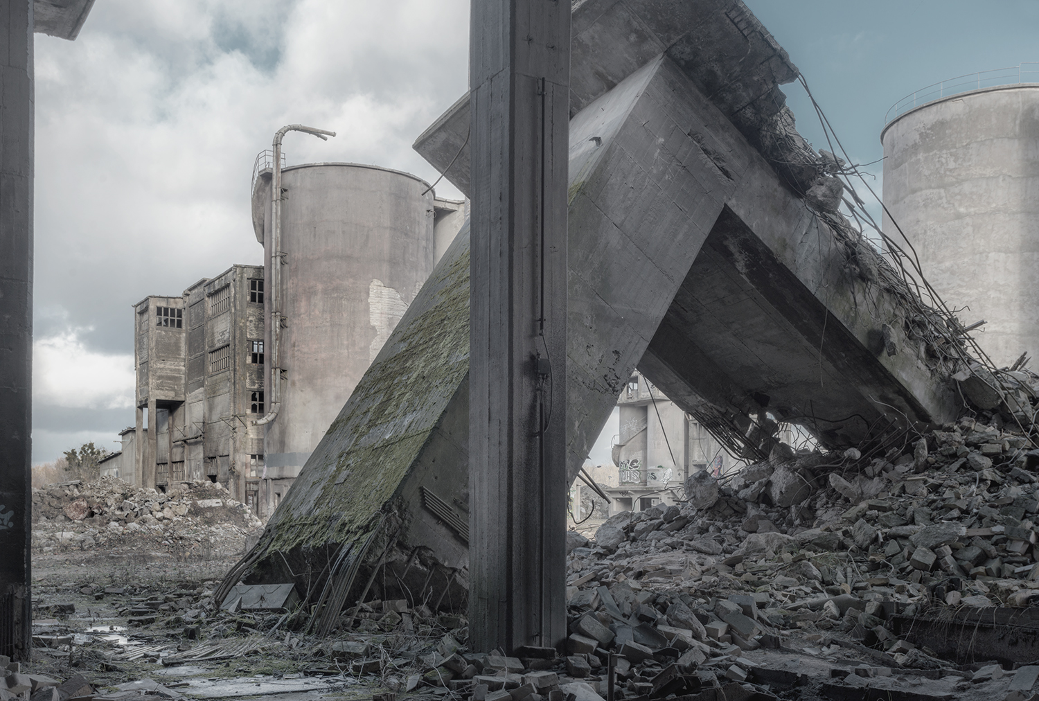
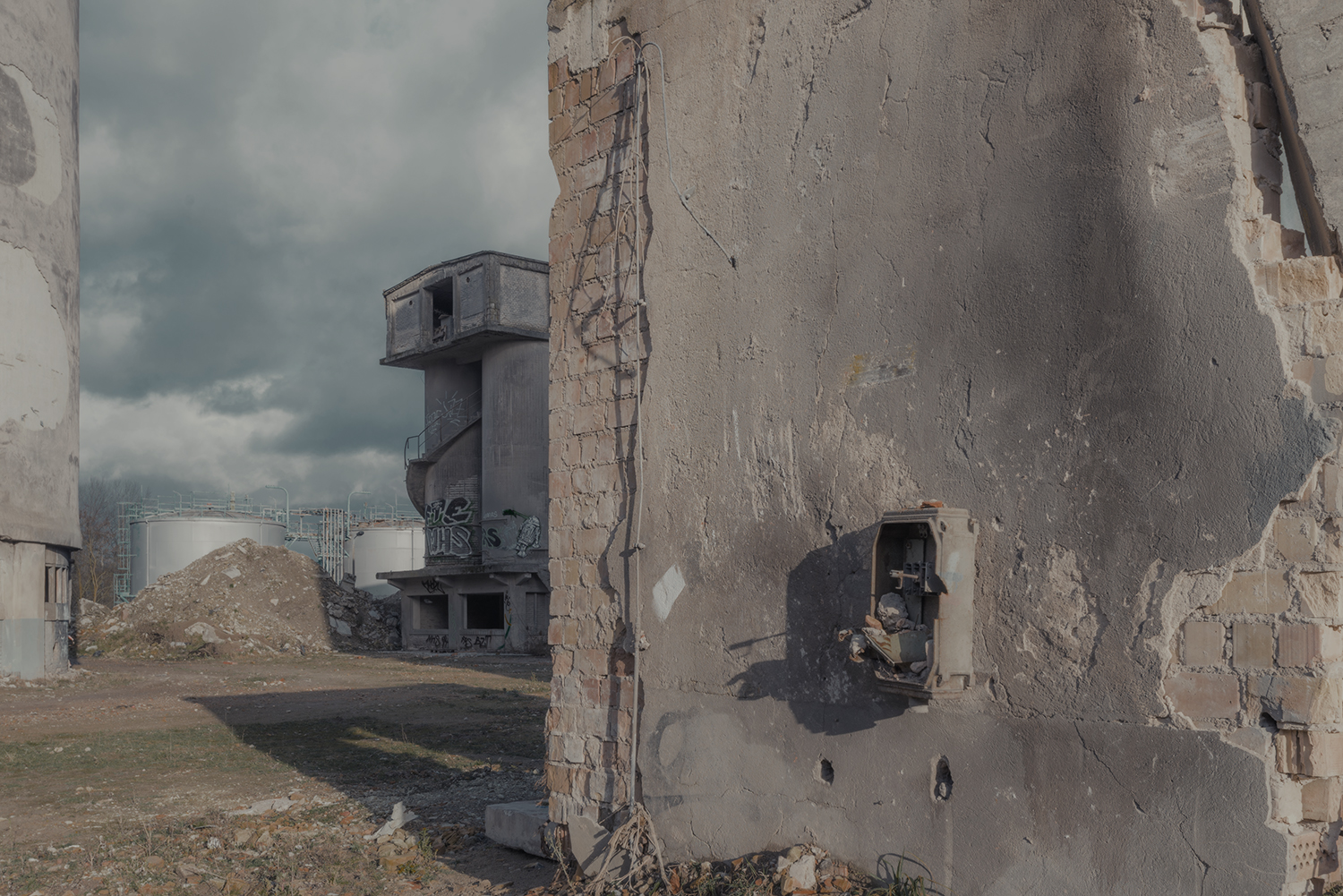
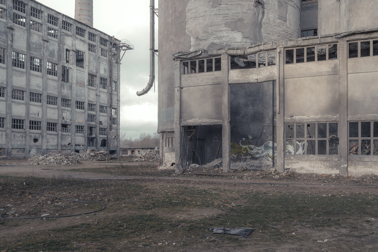
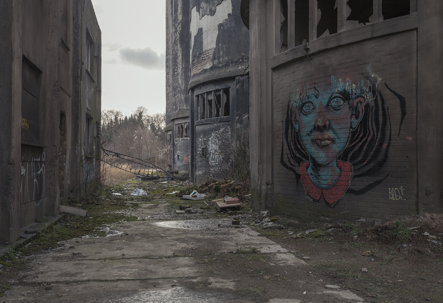
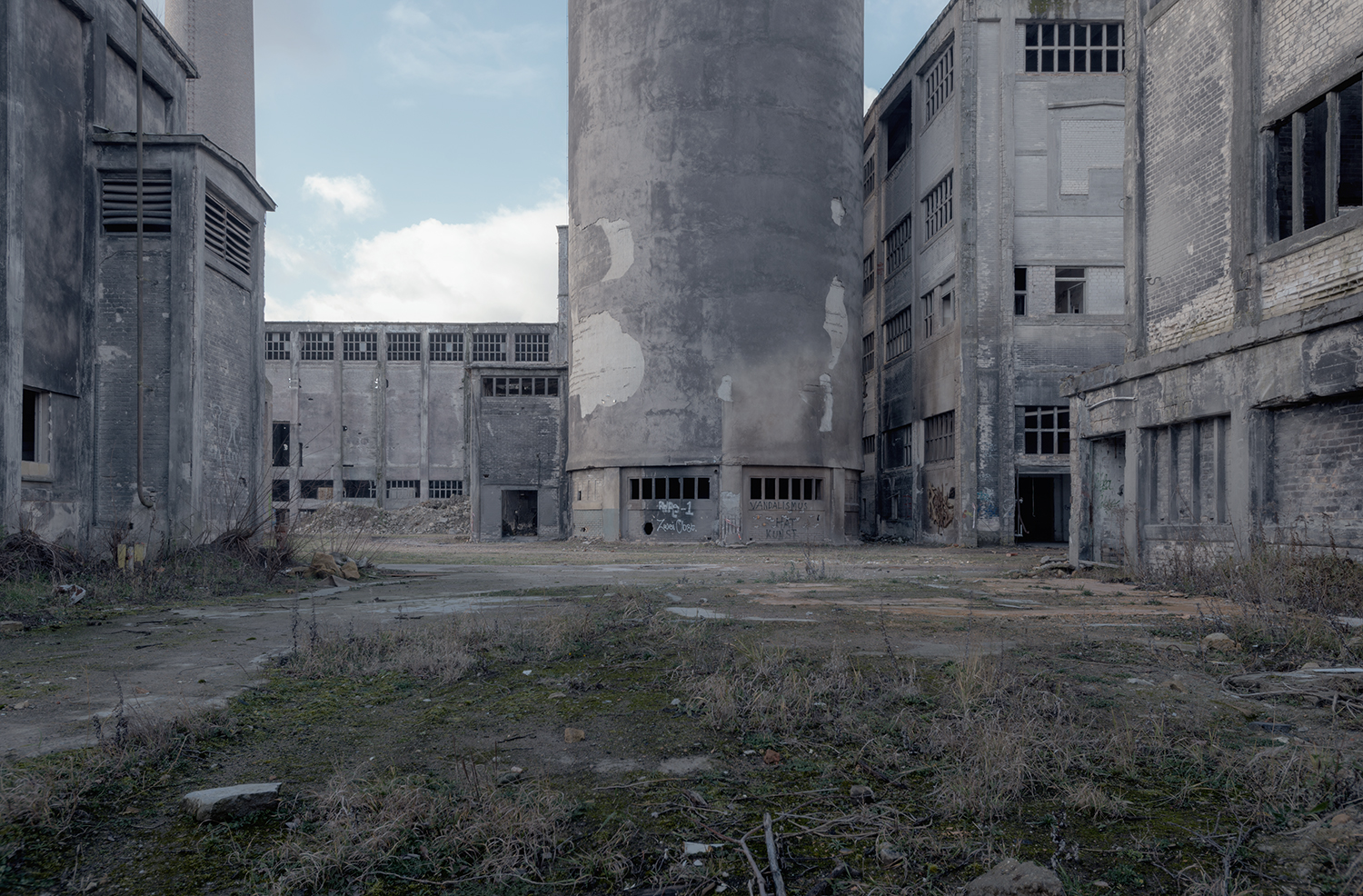
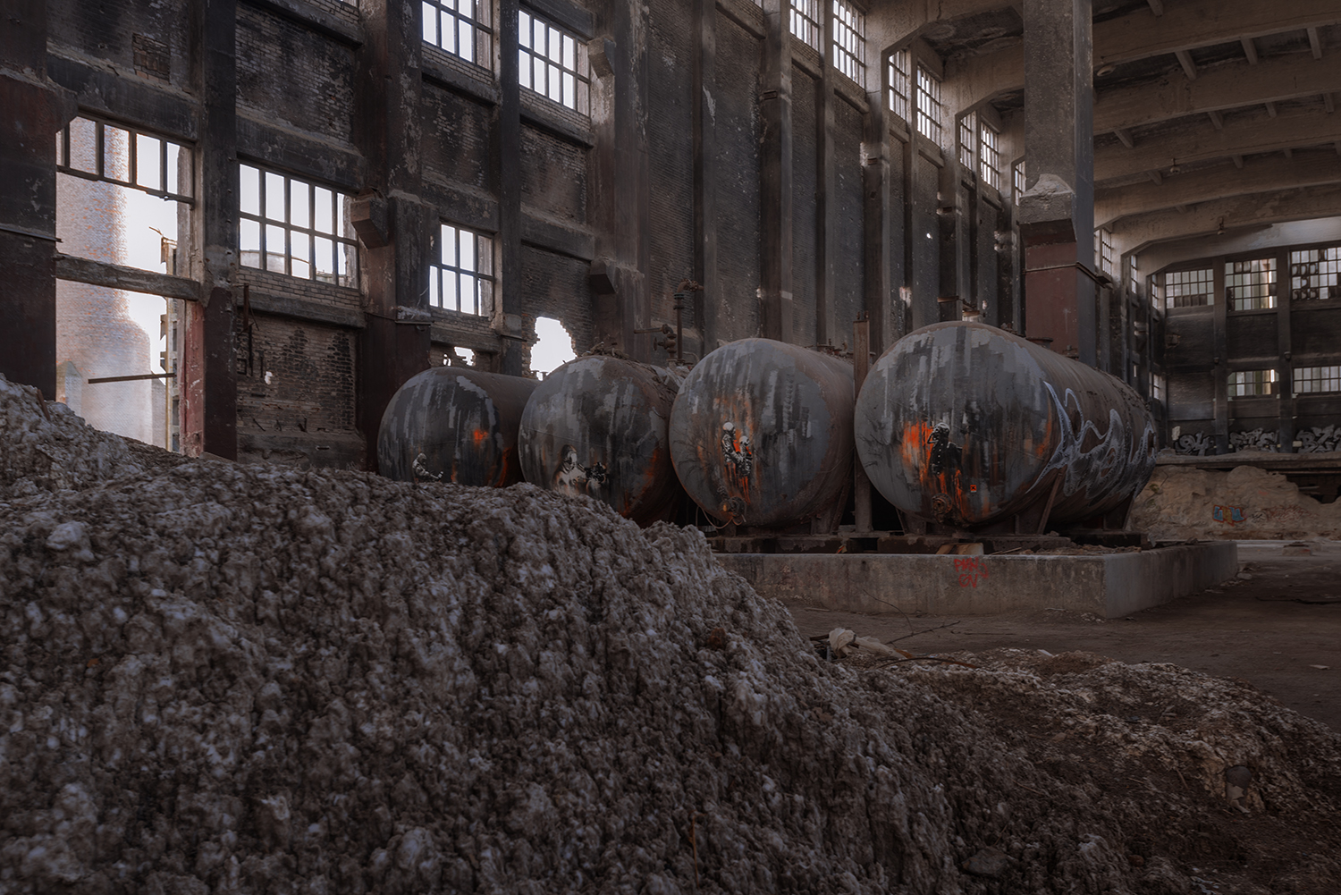
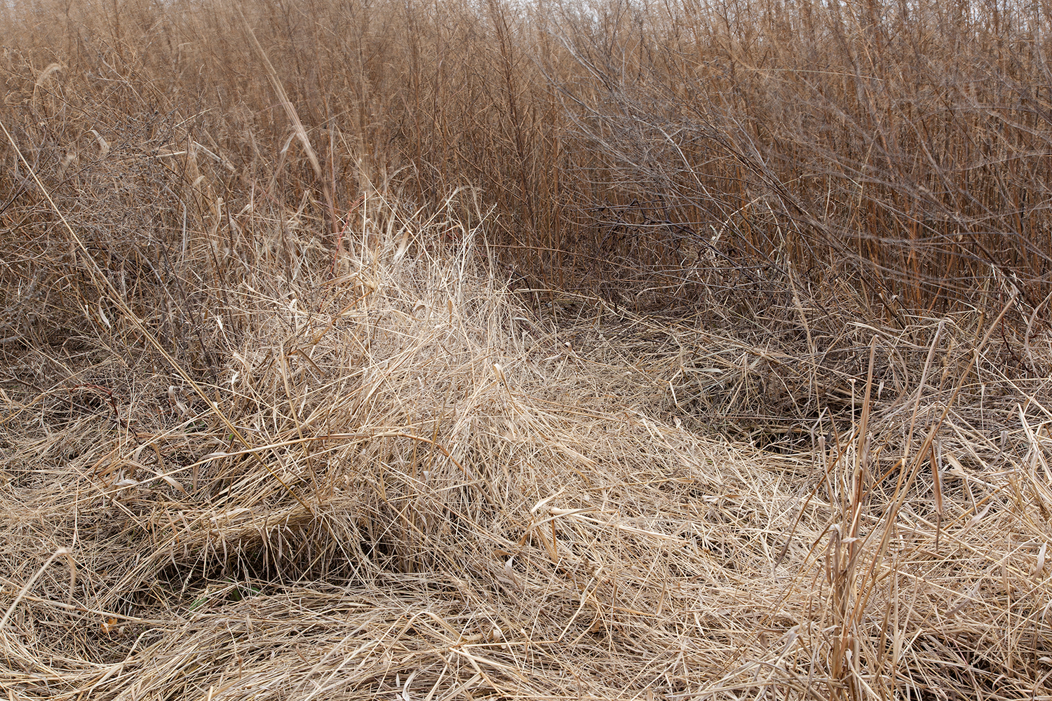
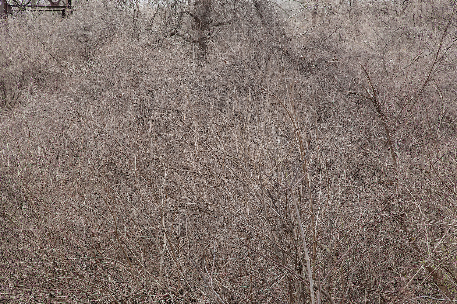
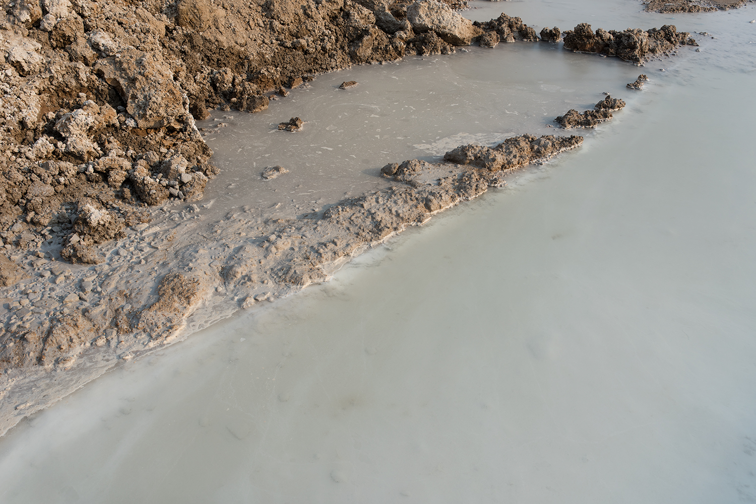
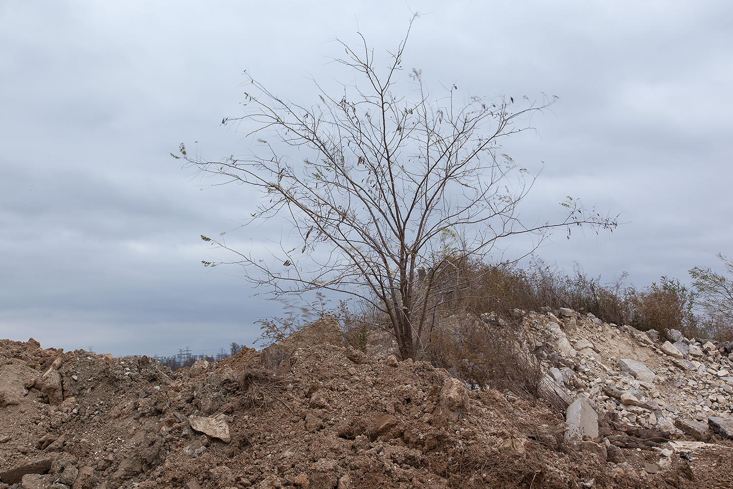
The English writer Marion Shoard took note of these complex environments and coined the term “edgelands” to describe these often overlooked and discarded spaces.  Thus, edgelands are loosely defined as places that occupy spaces both in between and on the periphery of inhabited and functional space. So, I am sure you are wondering in between what? Yet, the paradox of trying to assign a proper definition to the edgelands is that these spaces are transitory and therefore often tough to pin down and define. The edgelands are commonly found where the urban and rural collide, however, these spaces also exist around the periphery of parking lots, industrial sites, business parks, airports, waterfronts, suburban neighborhoods and alongside transportation corridors such as highways, rail lines and parkways. Due to urban migration, huge numbers of people now spend much of their time living, working, and or moving within or through edgeland space. Yet for most of us, this mysterious and unremarkable no man’s land often passes unnoticed in our daily commute.

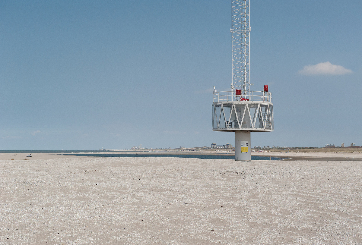
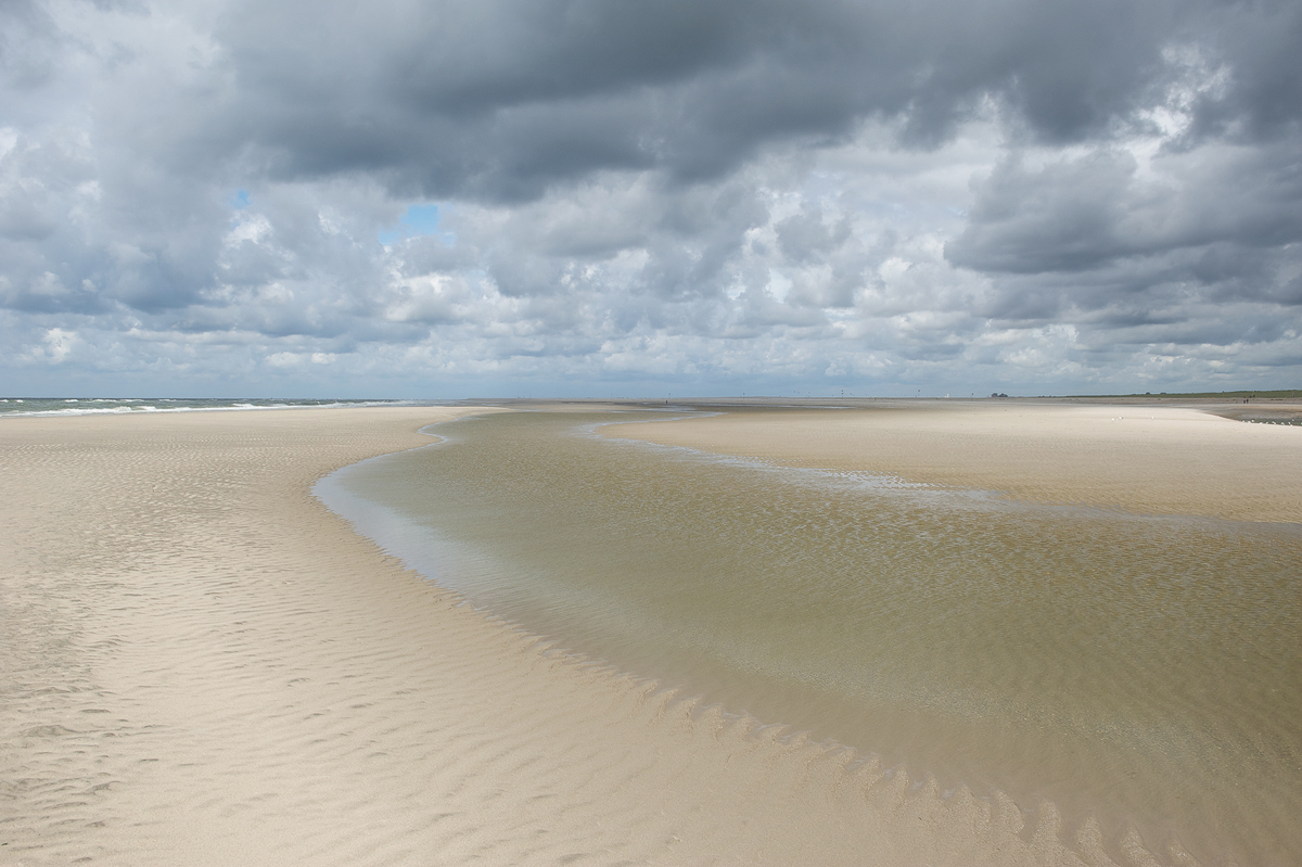
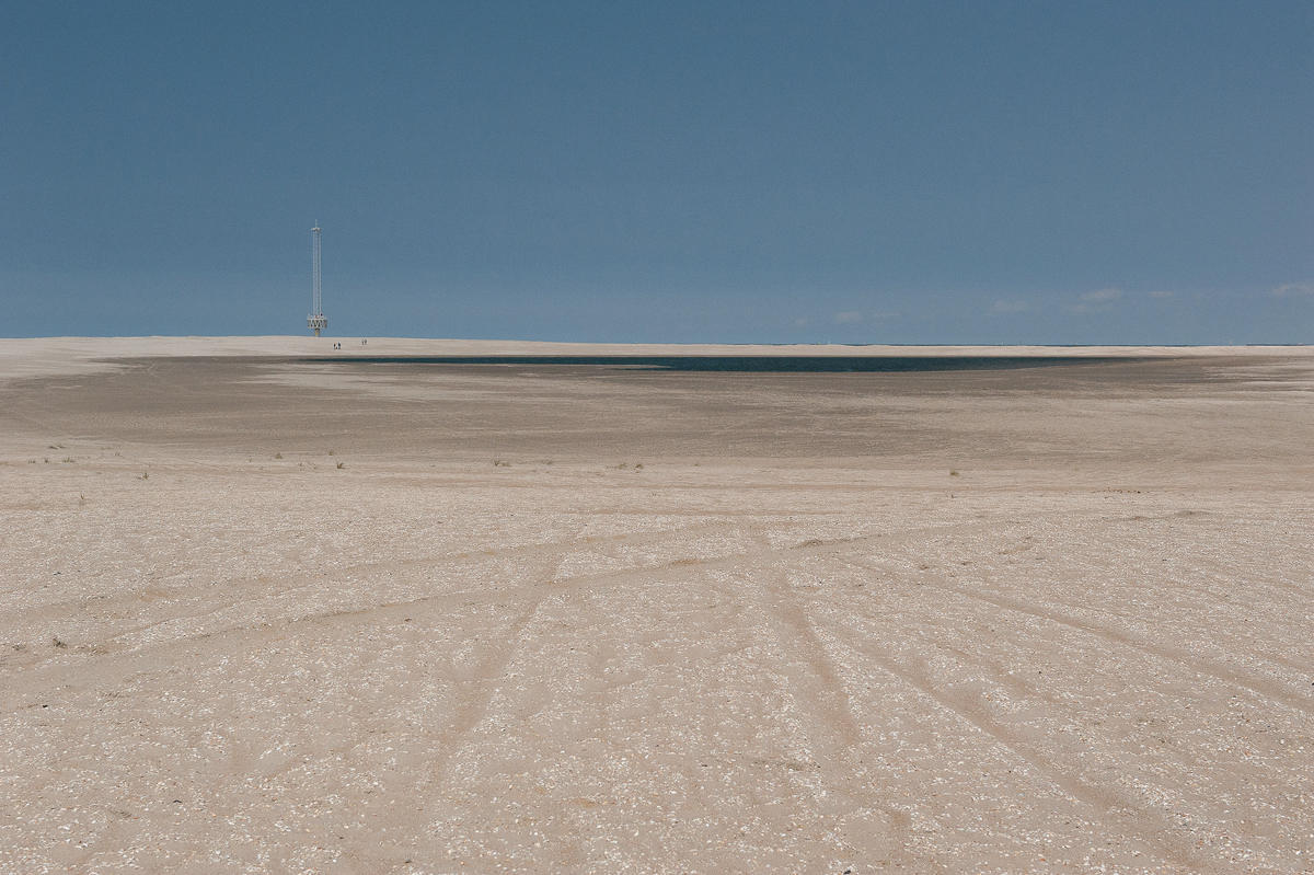
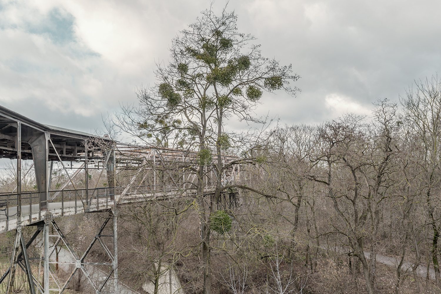
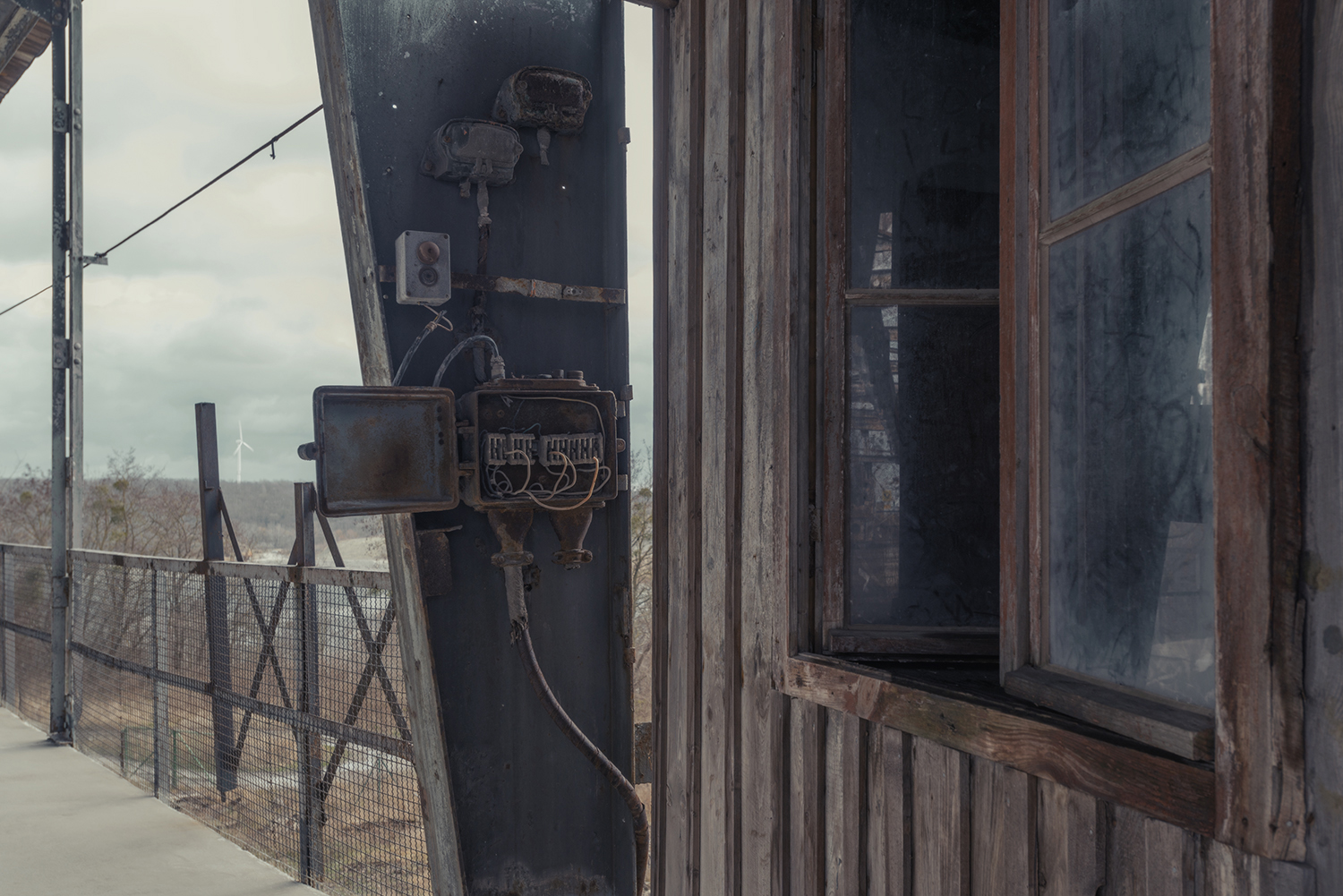
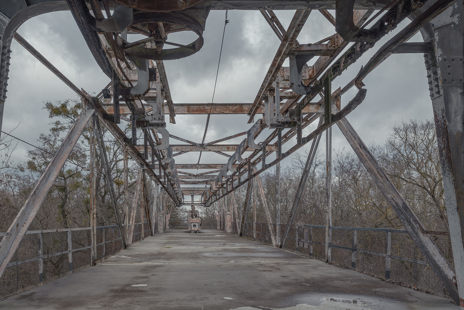
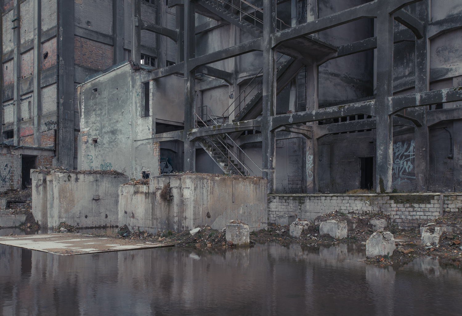
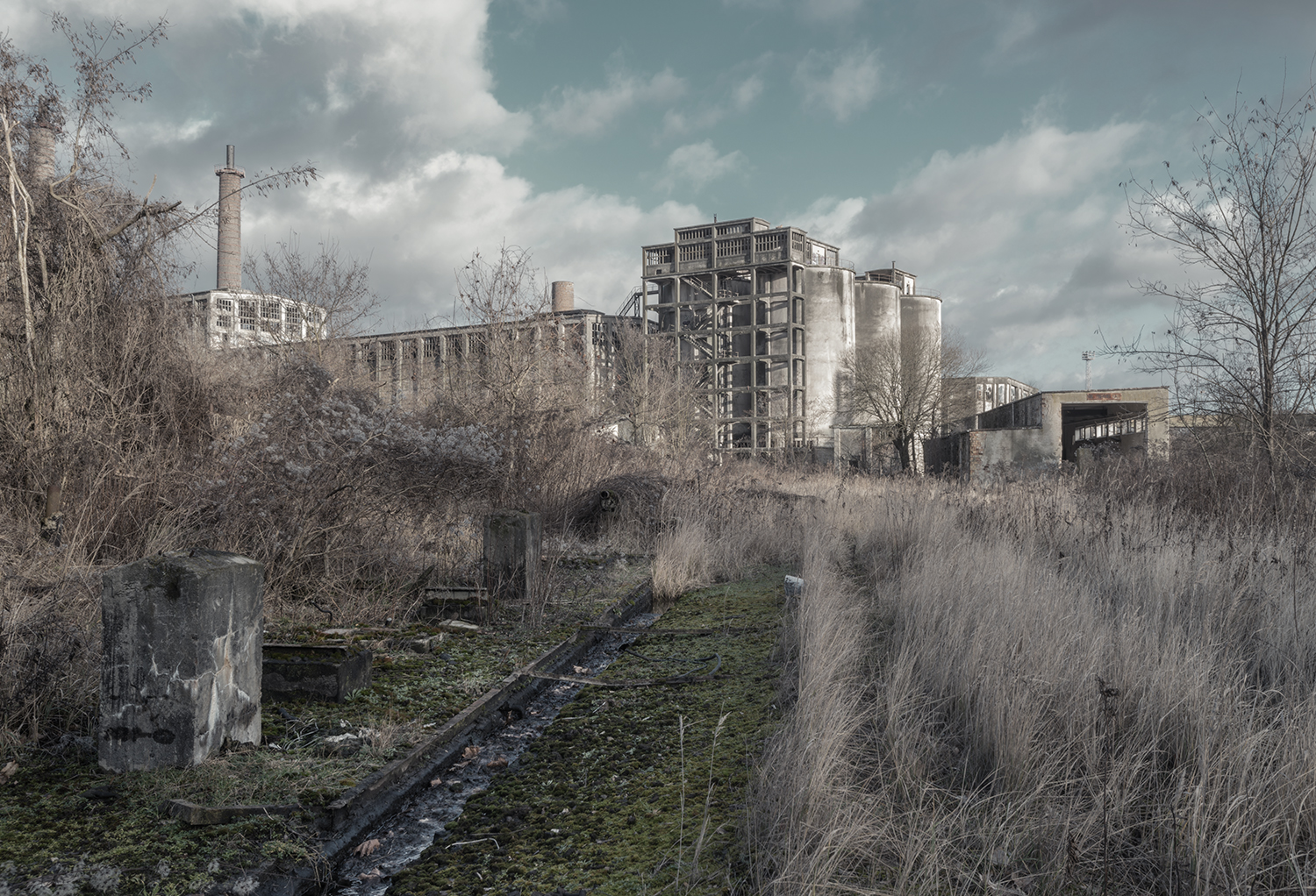
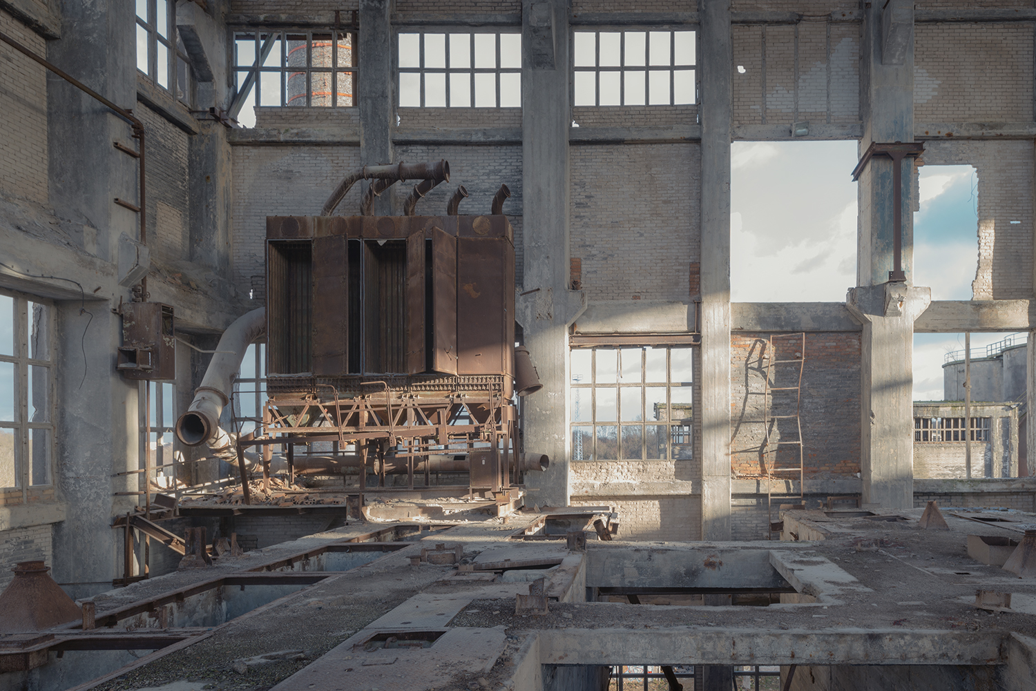
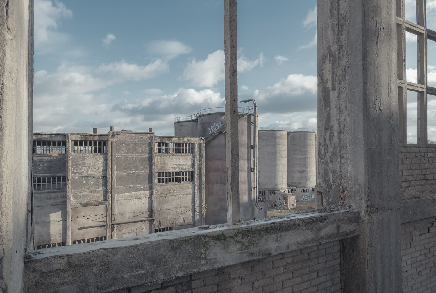
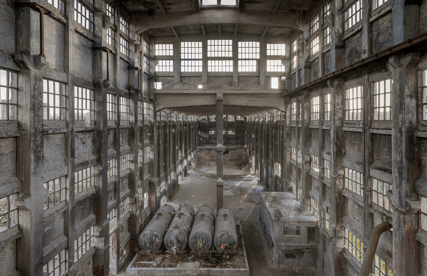
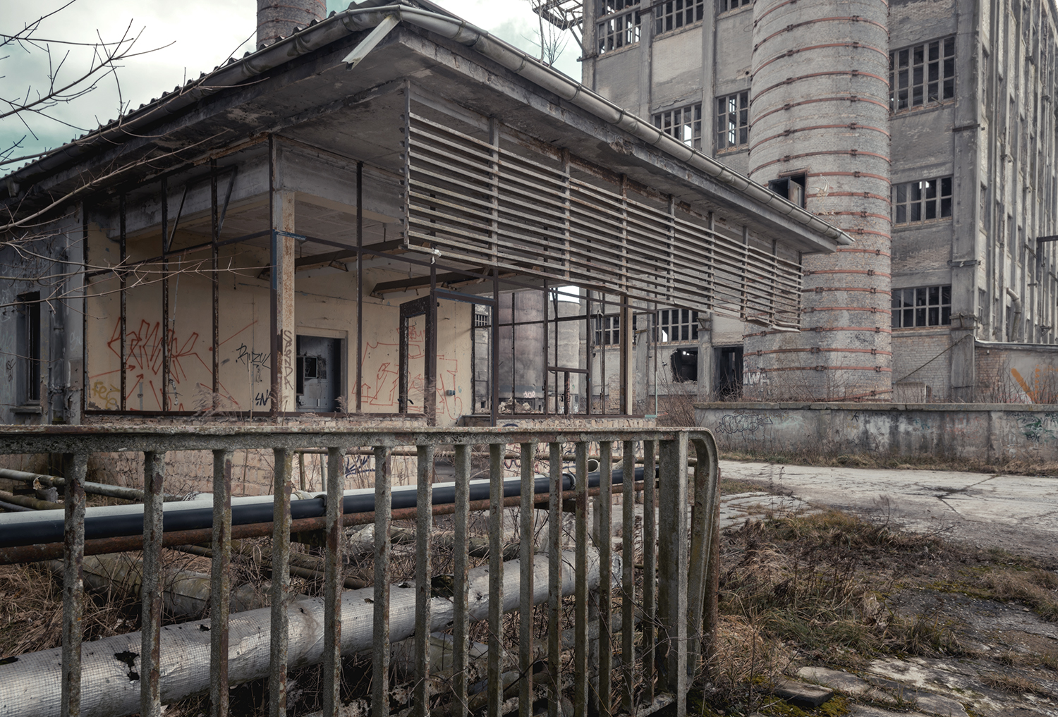
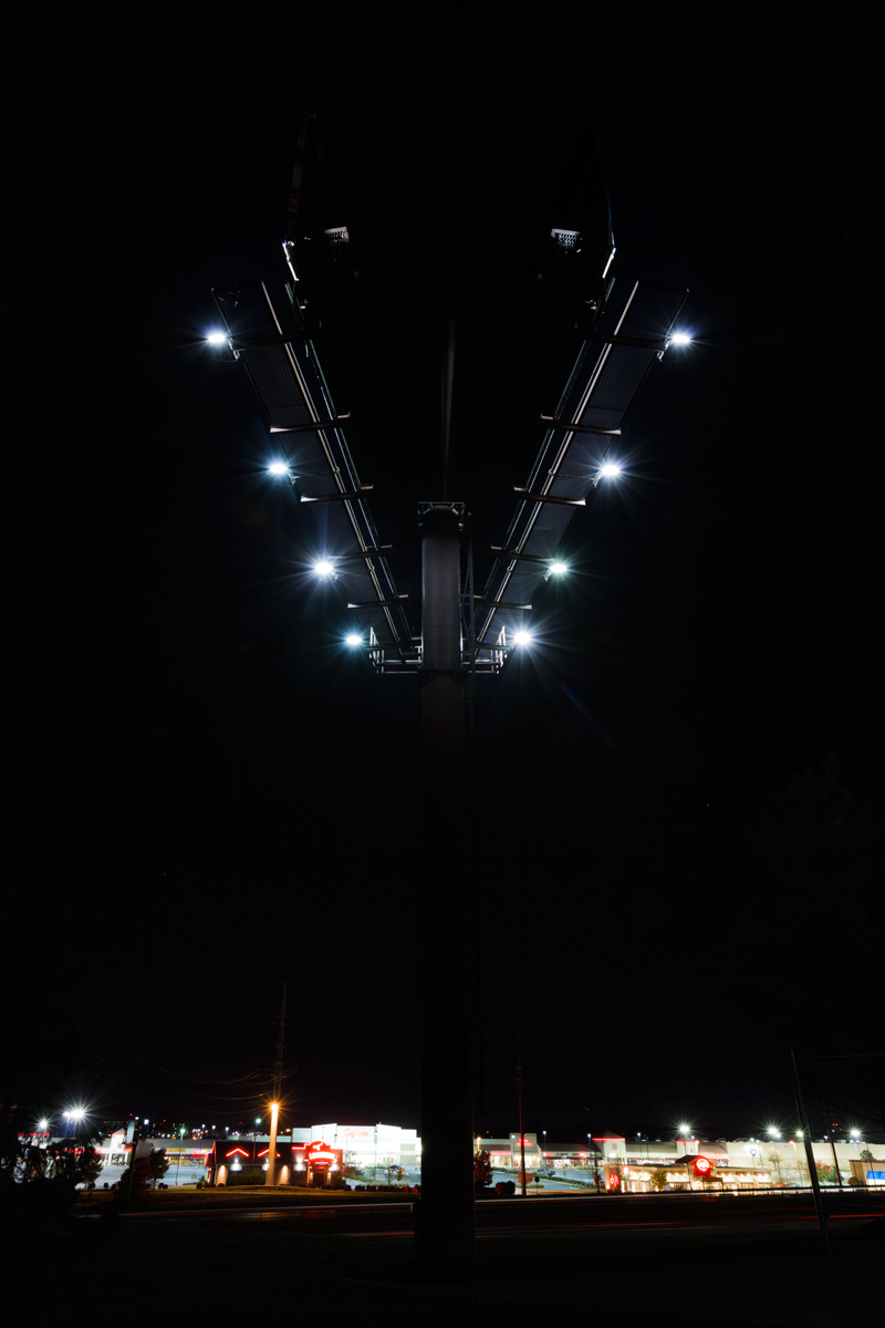
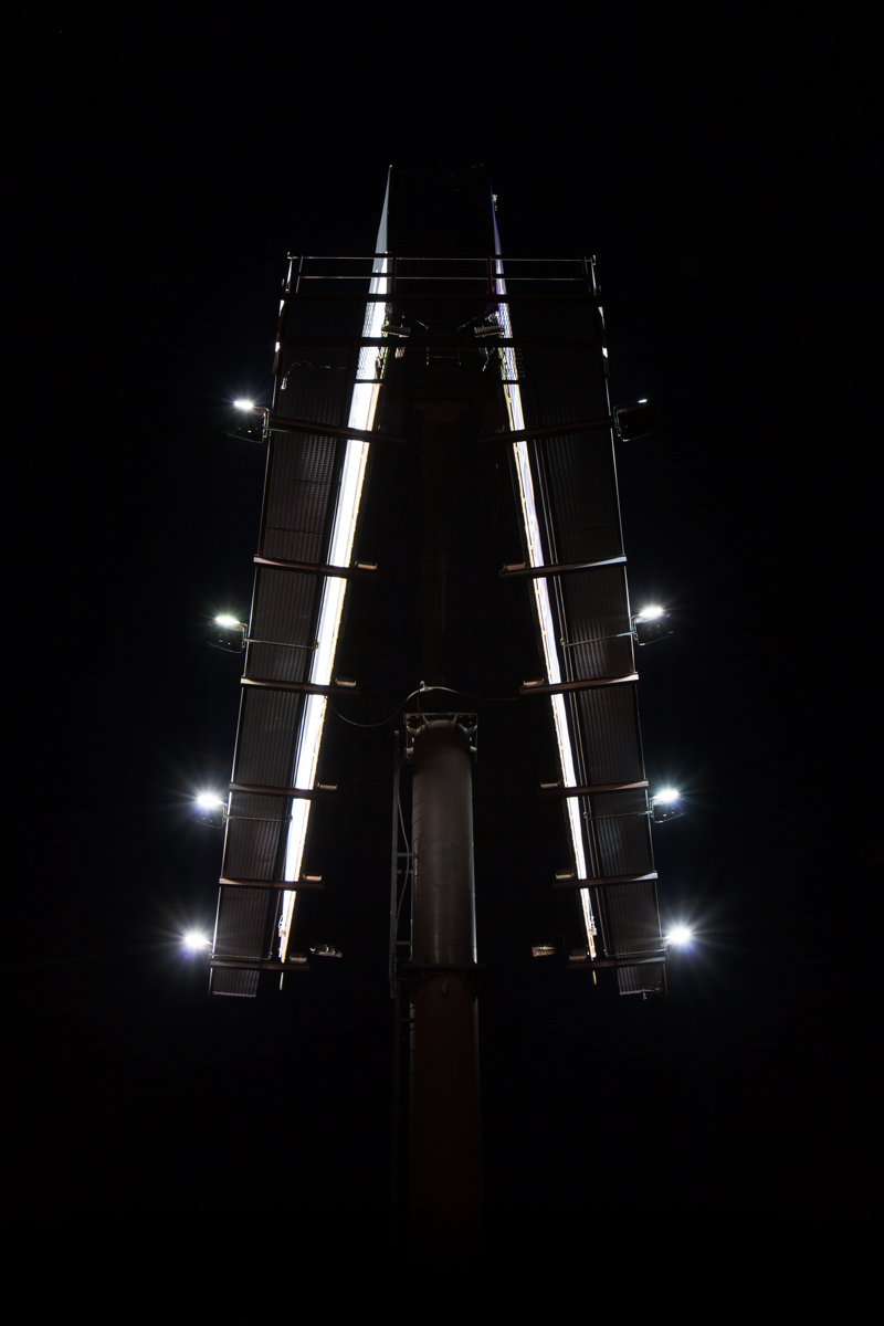
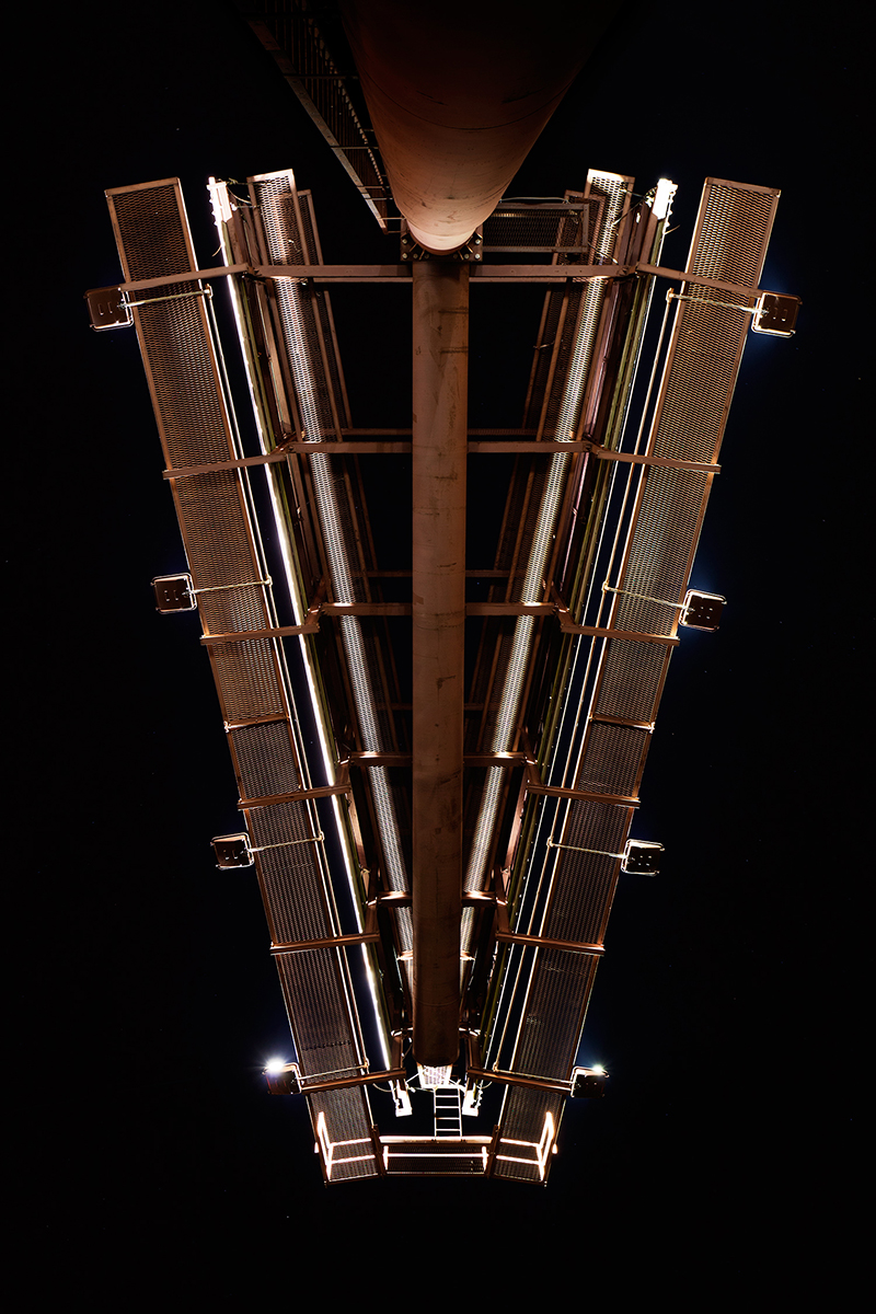
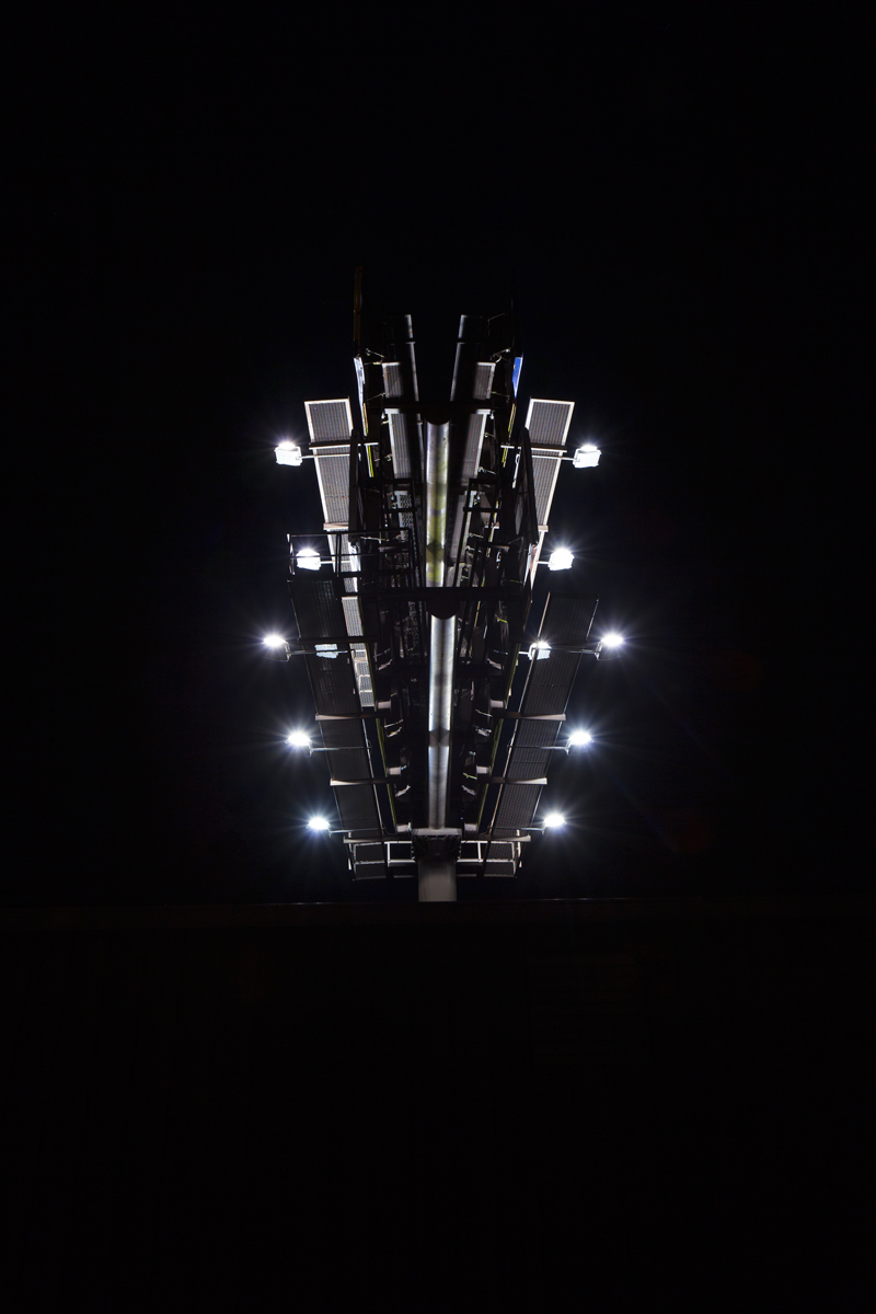
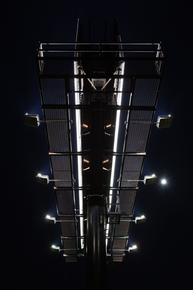
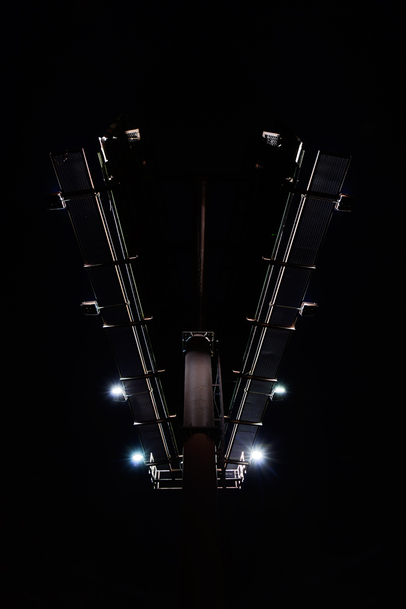
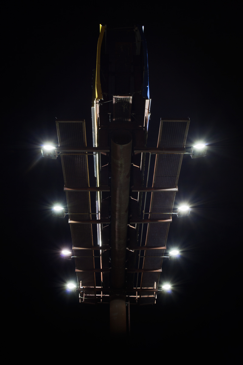
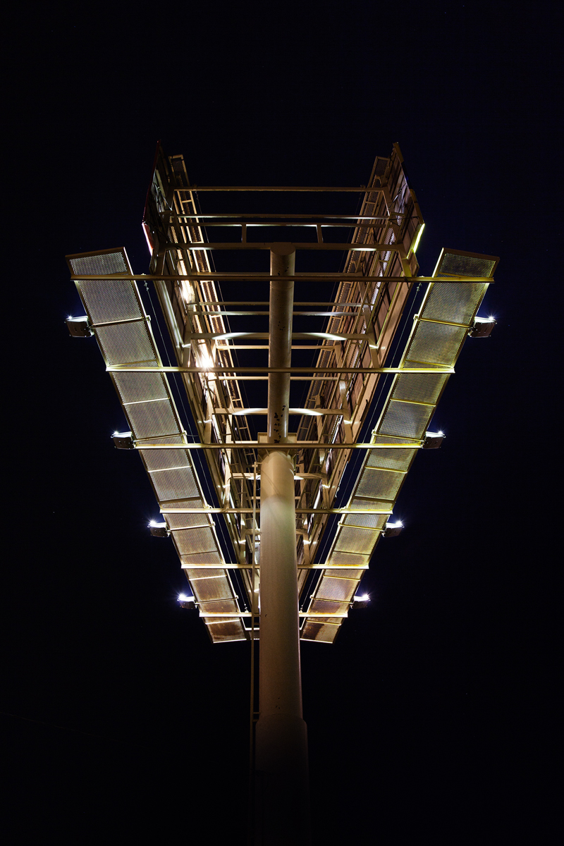
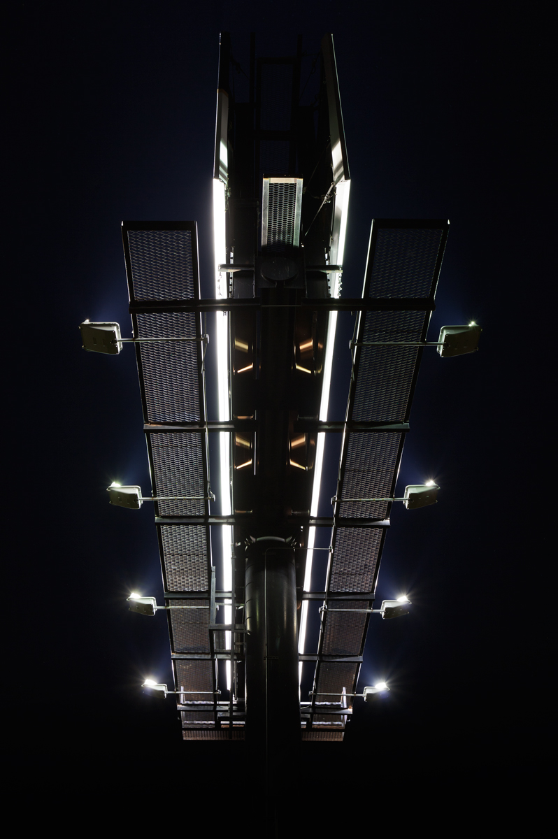
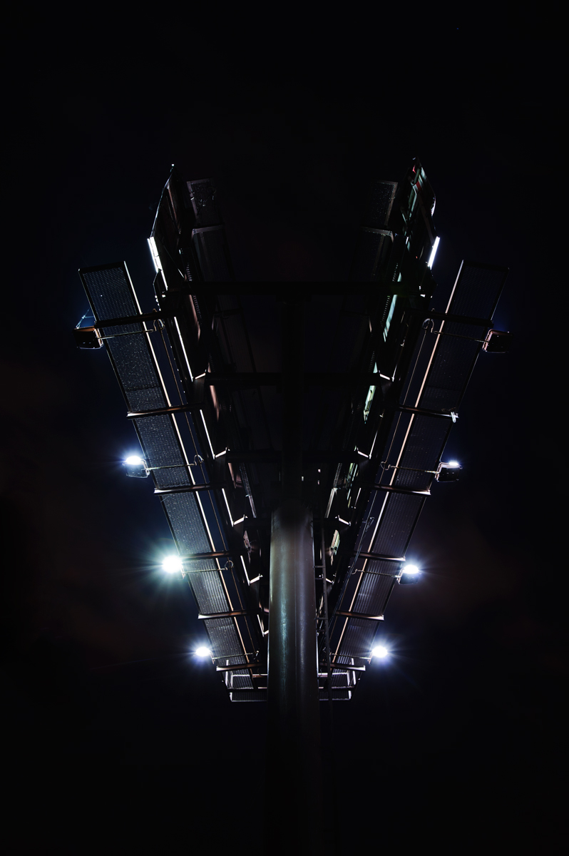
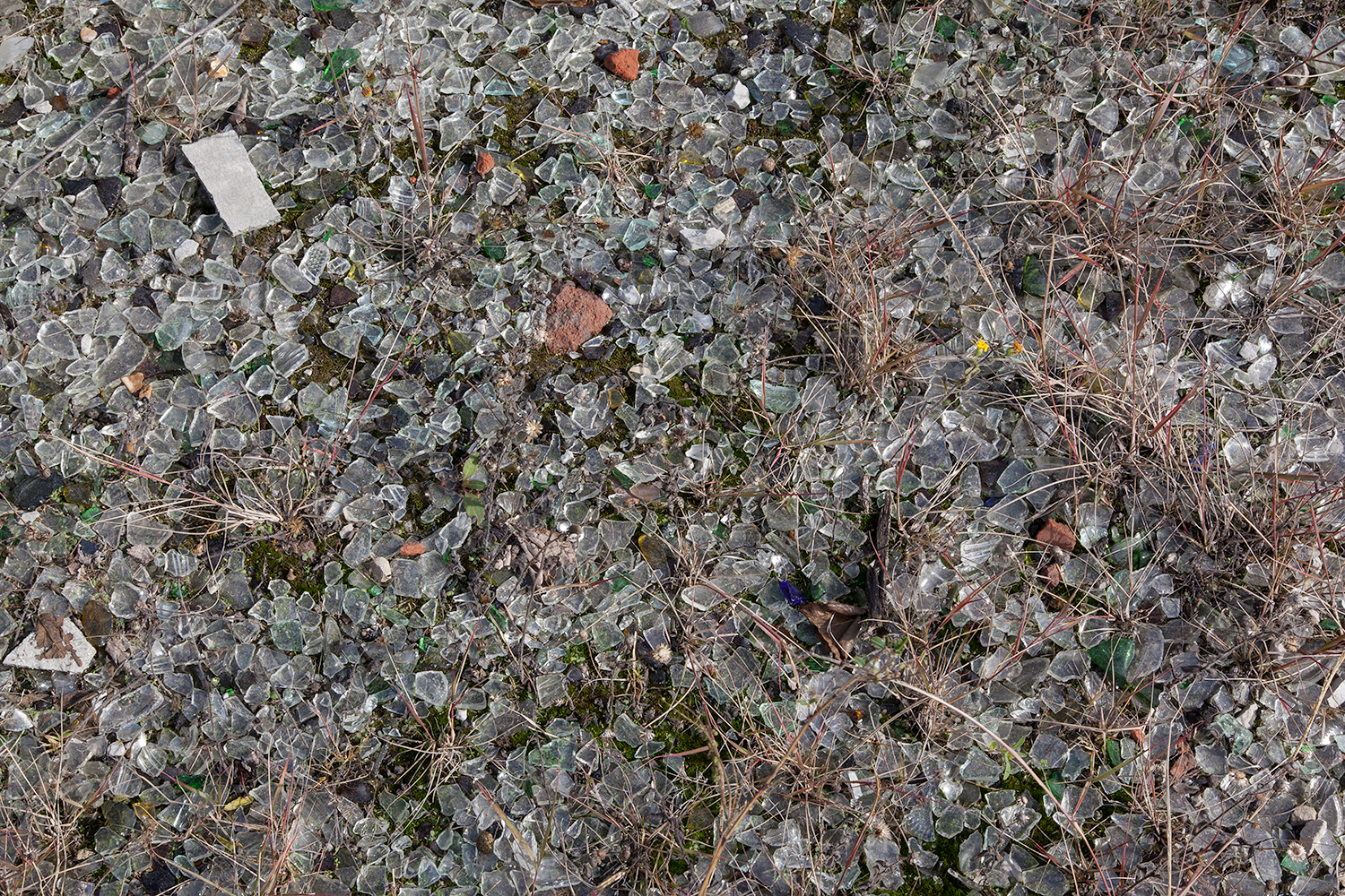
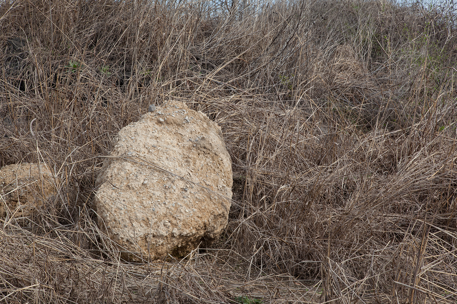
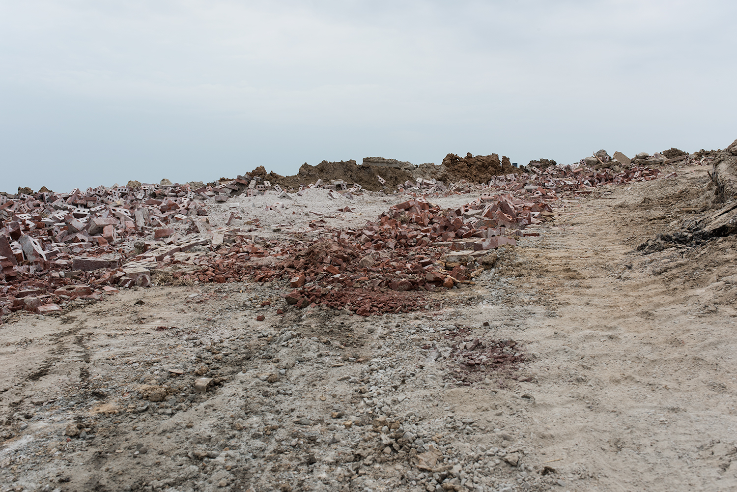
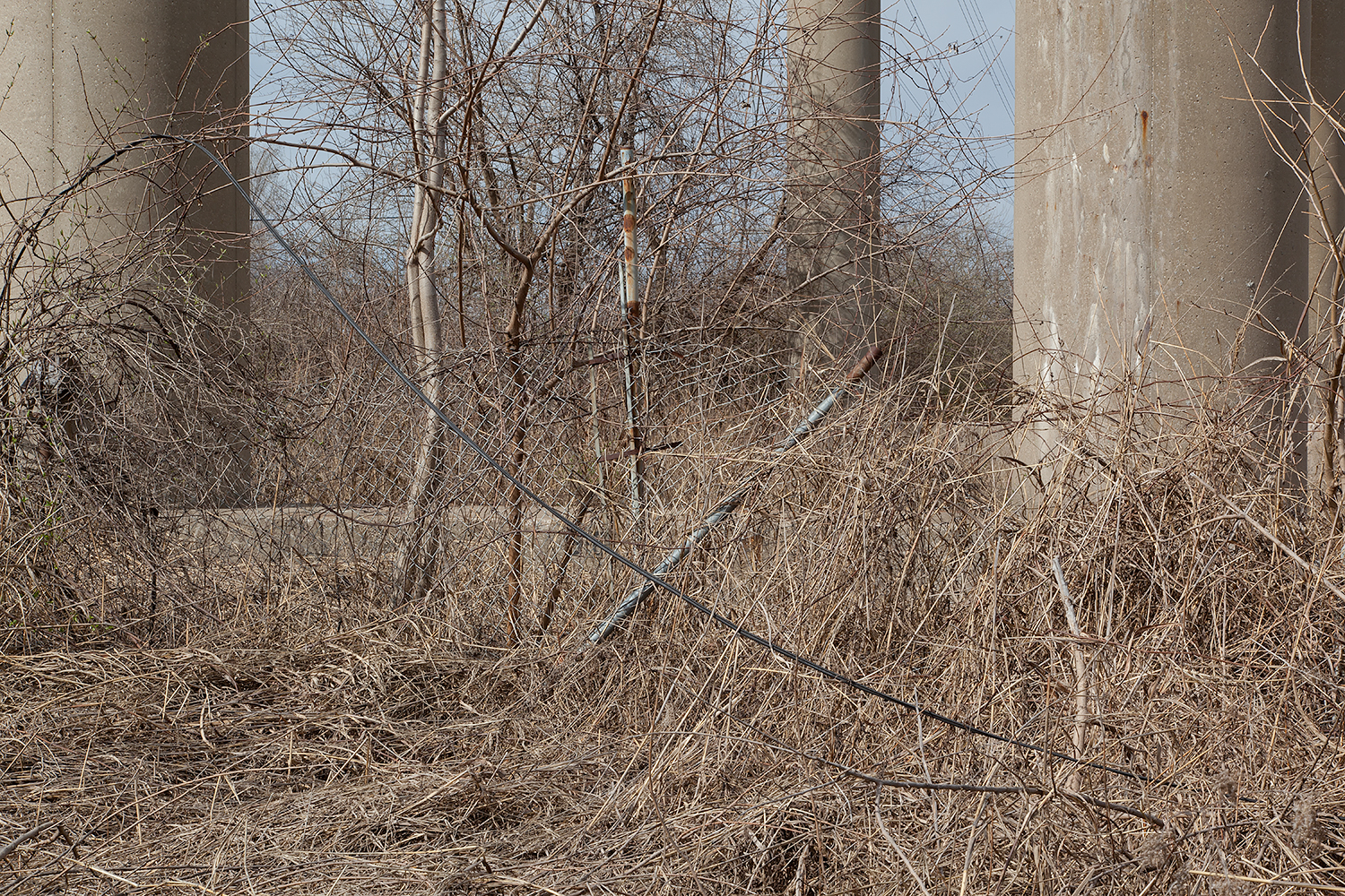
Photographer Jennifer Colten has spent a lot of time contemplating and documenting edgeland space. It is worth mentioning that the edgelands are an interesting place to point a camera as they are distinctively non-photogenic commonplace spaces.  However, Colten’s work reveals that there is something interesting happening in these humdrum urban corridors.  Her images reveal that there is in fact a unique and complex dialogue between nature and the built environment that exists in edgeland space. I had a chance to catch up with Jennifer Colten on concepts surrounding edgeland space and here is what she had to say:

1. How would do you define edgeland space and what is your fascination with documenting this space via the photographic medium?

Edgeland spaces are spaces that occupy a certain ambiguity. They are spaces that were not built for particular purpose nor used in easily identifiable ways. They are generally places at the periphery, or in between other more definable areas. Therefore we are not generally aware of them. The transience or flux of these kinds of places is interesting to me. In some ways, I see the photographic medium as perfect vehicle for exploring this kind of space. The spaces themselves are elusive and fleeting and photography, especially digital photography, is suggestive of this immateriality or fluidity of information.

2. Is edgeland space a place? Clearly edgeland spaces exist as we can find these locations through GPS coordinates; or for example, you could tell someone how to find a prior site you photographed. But does the human psyche treat these spaces differently, or in a manner that might challenge traditional concepts of place?

I think that in order for a site or a space to be defined as a “place” entails a sort of engagement with the space; a relationship that is produced through experiences, or memories, or even desires. This is why I title some of the images with the word “Encounter”. It implies a negotiation or relationship with the site. At one point, I was very interested in the idea of locating “place” and defining how or if that could be identified? Now, I am less interested in pinning down a definition of “place” because I see this as a shifting condition. This relates to the inherent qualities of ‘edgeland” spaces.

3. Do you find it challenging to draw beauty out of these environments or is this even your intent in photographing these spaces?

Beauty is a complicated word and such a big idea. I am not setting out to “beautify” these spaces, however, I do see a certain poignant aspect to these places. In an attempt to see a place that is filled with a complex and maybe paradoxical set of circumstances (from its quiet details, to an unsettling acknowledgement of its decay), I suppose there is a particular kind of beauty. I am definitely not interested in glamorizing places that have undergone destruction, social, or economic hardship. Nor am I interested in glamorizing the degradation of our environment. But, there can be elegance in seeing complexity and contradiction.

4. The photographic medium always produces output that is some part objective and subjective. With this in mind, do you approach the documentation of edgeland space with a more objective or subjective intent? Do you wanting viewers of your work to see these spaces for what they are, or something different, or maybe a combination of both perspectives?

One of the things that I love about photography is that it can be a continual paradox. On the one hand it can appear to present direct information. It can appear to be objective. However, photographs are never objective. They are always an interpretation, sometimes a fiction, and sometimes a complete fabrication. For me, it is the interesting line right in the middle that is compelling. When a photograph simultaneously, provides descriptive qualities that alludes to objective information, and also provides open space for interpretation and suggestion, it is most intriguing! So, I do want viewers to see the spaces both for what they are AND I want them to come away with questions, with discomfort, and with a powerful sense of poetic interpretation.

5. The English poets Farley and Symmons Roberts claim that the edgelands are interesting spaces because they cannot be pinned down. Do you think that these areas of our landscape remain fluid and dynamic or are they inherently more static and idle in nature, why?

I see edgeland spaces as fluid and ever-changing spaces. They might appear to be static, because often they are not obviously occupied and they are not clearly marked by traditional boundaries. It is this fluidity that I am particularly interested in. I often return to sites over and over, not only to remake photographs, but also to see the landscape as it changes with time and with weather and with season. I am interested in how the landscape shifts in response to both natural and man-made events. That nature and the literal shape of the land have a certain power and resilient capacity is strangely comforting. The concept that nature will evolve and change, often in spite of our interventions is a powerful fact.

I sometimes hesitate to put this idea out there because it is complicated. I firmly believe we humans have a deep responsibility to take care of the environment and to be held accountable for our activities; the environment has surely been affected by our irresponsible or oblivious decisions. However, that nature will survive and evolve in spite of us humans is hopeful.

6. Can the periphery, the margins, or edgeland spaces exist as productive areas of land, or do you think that these areas of land must exist in only a transitory or idle condition?

I frequently drive by a particular place that makes me think about this very question. Are there productive uses for those spaces that exist by happenstance? What about the spaces that are left over when the road is built and there is that awkward zone in-between the highway and the overpass? The spot I mention, is a very narrow strip of land that has been turned into an urban garden. This garden is extremely lush and productive and exists on a patch of land that was previously a dead zone. At one point, this garden was an edgeland space right in the middle of the city. Yet, for a time it was totally overlooked, a leftover piece of land that seemed to have been an afterthought. The proactive choice to use this space for a productive vegetable garden is beautiful!

The shifting aspect of edgeland space makes its very definition one that stays open ended and somewhat undefined. So, as this beautiful urban garden is now a place; meaning it has activity, it has purpose, it has usage and we are aware of it as a marked space, I suppose it loses its edgeland definition. It is the ever-changing transitory nature, or the seemingly idle condition that defines an edgeland space. But, we see that edgeland space can evolve into a productive space, and certainly productive places can transition into edgeland spaces.

7. Are edgelands a mere product of the growth of modern urban environments or do you think that they exist as some manifestation of the unknown, unexplored, or unfamiliar? Thus, do you think a concept similar to edgeland space existed for the 18th century farmer?

I think there is something closely related to the idea of the unknown or unfamiliar or unexplored. The edgelands to me are intriguing kinds of spaces because of their relationship to uncharted territory. It is the paradoxical relationship between the familiar kinds of places and familiar objects coupled with all the things that have been left behind that creates a tension.. The specific clues that reveal activity that once occupied the space, in contrast to the open ended and undefined aspect of these places creates a tension. What we think we know of a place is simultaneously unknowable.

8. What do you think about the idea of edgeland space existing as a wildlife corridor? Evidence suggests that there can be a lot of biodiversity in unmanaged spaces like edgeland areas. Do you think that edgeland spaces can exist as a place of refuge for flora/fauna and wildlife?

In my ongoing project, Wasteland Ecology, I am specifically looking at the ways the land shifts and reshapes itself around old industrial sites and old toxic waste zones. The ways that vegetation and even the shape of the land have been affected by human activity is profound. I have no training in plant biology or wildlife ecology, but it is clear to me that the landscape is altered. I have to imagine that the plant life is completely changed by human interventions. Thus, it is interesting to imagine that new species might evolve as a result of these alterations and that the unnoticed and unmanaged edgeland sites might be places where new growth can thrive. This concept speaks to the heart of my strangely hopeful outlook about nature’s resiliency. It just might be that these edgeland sites that are sometimes byproducts of our human industrial society provide the kinds of places where new vegetation and life can emerge.

Thanks for taking the time, this has been an enlightening conversation! You can find more of Jennifer Colten’s thought provoking work here: http://www.jennifercolten.com

References:

  1. https://en.wikipedia.org/wiki/Edge_city

  2. https://courses.planetizen.com/course/urban-design-edges

  3. https://gerryco23.wordpress.com/2014/02/09/wildness-on-the-edge-of-town-an-edgelands-encounter-with-paul-farley-and-michael-symmons-roberts/

  4. http://www.marionshoard.co.uk/Documents/Articles/Environment/Edgelands-Remaking-the-Landscape.pdf

Subscribe

Sign up with your email address to receive news and updates.

We respect your privacy.

Thank you!
Saturday 02.06.16
Posted by Ryan Nemeth
Comments: 1
 

LAND THIEVES: A war on rising tides

Sandmotor-04.jpg
Sandmotor-03.jpg
Sandmotor-04.jpg
Sandmotor-06.jpg
Sandmotor-02.jpg
Sandmotor-05.jpg
Sandmotor-01.jpg
Sandmotor-04.jpg Sandmotor-03.jpg Sandmotor-04.jpg Sandmotor-06.jpg Sandmotor-02.jpg Sandmotor-05.jpg Sandmotor-01.jpg

Images by:  Bart Van damme


Written by: Ryan Nemeth

The Dutch Sea Beggars were a sordid lot of sailors comprised of adventurers, pirates, and patriots who were fighting against Spanish rule in the Dutch provinces during the mid to late 1500s.  These pirates and privateers acting on behalf of their lowland nation found a good bit of success stealing the Spanish Empire’s wealth at sea. History tells us that the Sea Beggar’s efforts were the precursor to Dutch independence from Spain as well as several centuries of Dutch global maritime dominance. The other development that contributed greatly to Dutch prosperity during this period was success in transforming their agriculture through hydraulic engineering. Did you know that approximately one-quarter of the Netherlands lies below sea level? Therefore, it is both striking and a sign of human ingenuity that the Dutch continue to create competitive advantages for their country via their unique land management efforts and a deep and sordid history with the sea.  The Sand Motor project, is yet another pioneering land transformation endeavor that is enabling the Dutch to safeguard their land from depths of the ocean.  

Hold your horses people, we will get into the details of the Sand Motor. Let’s first explore the history and evolution of Dutch land reclamation efforts through windmills, dykes, and polders. As Doug E. Fresh would say, Tic Toc and you don’t stop and it goes a little something like this, hit it... In the first century A.D. people began building artificial hills, called terps, and locating their villages and towns on top of them so that when floods came their homes would be safe. After a while it occurred to these people that if they connected the terps together with long walls, called dikes, they could keep water out of their farmland. Thus, the Dutch built dikes around water saturated areas of their land. The next stage of evolution in land transformation involved pumping water out of the lowlands.  In order to do so, pumps were connected to wind powered mills, enter the windmill in the Dutch landscape.  Successful efforts to expand this network of dikes and the use of windmills furthered land reclamation capabilities and capacities.  Many centuries later, the end result and application of this ingenuity enabled the Dutch to transform bays, flood zones, marshes, and lakes into arable and inhabitable land.  These recovered areas of land surrounded by dikes were given the name polder. Thus, dikes, windmills, and the creation of polders are features of the Dutch landscape that are inextricably linked to one another. If you were wondering how on earth you reclaim land from the sea, this folks is exactly how you do it!

Hopefully it is evident by way of the abbreviated history presented that the Dutch are engaged in what seems like an endless battle to preserve their land from the depths of the ocean. Although windmills are now picturesque and cliché symbols of Dutch culture, they are also objects tethered to a long history of environmental struggle. This struggle, the coinciding efforts, and a relentless obligation to contain nature have persisted from father to son for centuries. Thus, environmental awareness is a huge part of Dutch cultural identity. Many would argue that this level of awareness was birthed out of a deep and sordid history with flood control and intense land transformation efforts. The popular proverb, “God created the Earth, but the Dutch made Holland,” says it all.  However, this is more than proverbial truth, as it speaks to a very tangible cultural reality in the Netherlands, the Dutch are co-creators in their functional landscape.

Like any good story, the saga continues, enter the “Sand Motor” in the Dutch landscape. Although the branded “Sand Motor” project begs for a literal interpretation, it is hardly that.  I have to admit that this name immediately conjured up scenes from Mad Max. I was hoping to discover the biggest and baddest machine on earth in action. Clearly, we all need a 2000 horsepower machine that can sling many tons of sand hundreds of meters in 10 seconds flat. All I have to say is that it was a good pipe dream while it lasted! However, the Dutch are way smarter than this. They happen to have a long history of working with the forces of natural energy (kinetic) to aid their landscaping and earth moving efforts. Windmills and the coinciding hydraulic energy they produce are a prime example of this applied intellect.  In the case of the Sand Motor project, the Dutch are using the ocean’s currents as a means for building up their beach. So you ask why? This project is a direct response to projected sea level rise and a derivative of this coastline intervention method that has helped the Netherlands combat coastal erosion since the 1970s.  It you are wondering what we might do to combat rising seas in the near future?  Read on, the solution might be in front of our face, thanks to the Dutch!

The global science community largely agrees that climate change and rising sea levels will pose a significant threat to deltaic, estuarine, and other low-lying coastal regions in the 21st century.  The damage done by hurricane Katrina in 2005 was a global wake-up call to many countries concerned about the potential consequences of coastal flooding. In fact, this incident galvanized the need for a 2nd Delta Committee in the Netherlands. The Netherland’s is largely comprised of river delta and is therefore faced with potentially massive socio-economic consequences in the event of flooding related to sea level rise. More than half of the Dutch population (9 million people) currently reside in coastal regions, with nearly 65 percent of the Dutch Gross National Product being produced in these coastal regions. Thus, there is a considerable amount at stake for their country and our global community in coming decades.

The “Sand Motor" aka the “Sand Engine”, is a sand nourishment project comprised of 21 million cubic meters of sand. This is roughly 67,000,000,000 trillion pounds of sand, literally, a shit ton of sand!  But what is it you ask? The “Sand Motor” is a man-made hook shaped sand bar that stretches out from the natural beach to form a peninsula in the ocean. Between March 2011 and November 2011, Rijkswaterstaat and the provincial authority of Zuid-Holland broke ground on the 70 million euro sand-spreading project. Globally, the project is notable because its magnitude and scale are unprecedented.  As mentioned, the Dutch have been building sand bars on a smaller scale to combat sea level rise since the 1970s. So what is the difference compared to prior sand replenishment efforts and why such change?

Historically, the Dutch applied sand directly to their dunes and receding beaches. Learning from this process, beginning in the 90s, the Dutch began utilizing shore facing or shorefront sand nourishment methods. This method utilized natural marine processes to redistribute sand placed under water in a cross-shore direction. This gradually created a wider beach and increased coastal defenses over time. The difference is that the Sand Motor is considered a mega-nourishment of sand and it exploits both the energy from water currents as well as wind to redistribute sand in both cross and along shore directions. Thus, the hope is that there will be more sand spreading coverage that utilizes energy from both natural sources (wind and waves).

It is interesting to consider some history here. In the 1990s, Dutch sand replenishment activities were usually on the scale of 1-2 million cubic meters. This was the total sand applied annually and these efforts were usually effective enough to provide 3-5 years of coastline protection. The sad truth is that the size and magnitude of these replenishment efforts have grown simply from current climate modeling data. In 2009, the aforementioned 2nd Delta Committee indicated that to negate the enhanced potential for coastal recession, due accelerated sea level rise in the 21 century, the yearly sand nourishment volume for the Dutch coast should be increased from a total volume of 12 million cubic meters to 80 million cubic meters a year. This proposal is ultimately what led to the methodology change and the concept of the “Sand Motor”.

The justification and main advantages of the Sand Engine concept are: (a) sand replenishment is only required approximately every 20 years as opposed to the 2-5 year cycle of prior methods; (b) the sand replenishment will slowly diffuse and advance the shoreline over a 10 km stretch of the coastline and in a more natural fashion; (c) the large initial local ecological disturbance will result in a short to medium term increase of locally available space for recreation and the environment, and (d) the ecological stress, while considerable at the initial nourishment location, does not disturb adjacent areas, thereby limiting the disruption to a small 2.5 km area. Currently, the project and local area are being researched extensively and evaluated via multidisciplinary research methods. While the jury is still out on this unique intervention, if proven successful, it may well become a global generic solution for combating sea level rise driven coastal recession on open coastlines.

P.S. If you live in Hawaii, Tahiti or any the Pacific Islands, I am sending this message to you, maybe there is hope after all!

References:

  1. Stive, M., De Schipper, M., Luijendijk, A., Ranasinghe, R., Van Thiel de Vries, J., Aarninkhof, S., Van Gelder-Maas, C., De Vries, S., Henriquez, M., Marx, S. (2013). The sand engine, a solution for vulnerable deltas in the 21st century. Coastal Dynamics 2013. Retrieved from: http://www.coastaldynamics2013.fr/pdf_files/148_Stive_marcel.pdf.
  2. Bruyneeel, M. (No date) The Dutch Sea Beggars. http://zeerovery.nl/history/beggars.htm
  3. Krystek, L. (2011). The Zuiderzee and Delta Works of the Netherlands. Retrieved from: http://www.unmuseum.org/7wonders/zunderzee.htm.
  4. Maddison, A. (2015). The Netherlands from 1600 to the 1820s. Retrieved from: http://www.theworldeconomy.org/impact/The_Netherlands_from_1600_to_the_1820s.html
  5. McKinney, V. (2007). Sea level rise and the future of the Netherlands. Retrieved from: http://www1.american.edu/ted/ice/dutch-sea.ht  

Subscribe

Sign up with your email address to receive news and updates.

We respect your privacy.

Thank you!
Saturday 02.06.16
Posted by Ryan Nemeth
 

RUINS: Post-Industrial Society

01-DSC_2868-t.jpg
01-DSC_2871-t.jpg
01-DSC_2876-t.jpg
01-DSC_2898-t.jpg
01-DSC_2903-t.jpg
01-DSC_2923-t.jpg
01-DSC_2925-t.jpg
01-DSC_2929-t.jpg
01-DSC_2940-t.jpg
01-DSC_2946-t.jpg
01-DSC_2948-t.jpg
01-DSC_2953-t.jpg
01-DSC_2954-t.jpg
01-DSC_2967-t.jpg
01-DSC_2971-t.jpg
01-DSC_2977-t.jpg
01-DSC_2980-t.jpg
01-DSC_2984-t.jpg
01-DSC_2868-t.jpg 01-DSC_2871-t.jpg 01-DSC_2876-t.jpg 01-DSC_2898-t.jpg 01-DSC_2903-t.jpg 01-DSC_2923-t.jpg 01-DSC_2925-t.jpg 01-DSC_2929-t.jpg 01-DSC_2940-t.jpg 01-DSC_2946-t.jpg 01-DSC_2948-t.jpg 01-DSC_2953-t.jpg 01-DSC_2954-t.jpg 01-DSC_2967-t.jpg 01-DSC_2971-t.jpg 01-DSC_2977-t.jpg 01-DSC_2980-t.jpg 01-DSC_2984-t.jpg

Images by: Markus Lehr - From the series: Modern Ruins


Written By: Ryan Nemeth

Factories and industrial sites are more than just standardized homogenous places where we produce things. During the industrial revolution, industrial zones and production centers also served as community outlets and incubators for innovation. Our factories and assembly lines were the places where we produced value for society and challenged mediocrity. In doing so, scaled manufacturing became the 20th century model and mechanism for ushering in wealth and culture to the Western World. Thus, industrial centers also became the rallying points for generating the competitive advantages needed for our economic growth.  Under this industrial economic model, societal benefits were numerous and we had both rationale and incentive to build and maintain the “factory town”.  

As a result, the factory floor was a place that provided for generations of our families. For the better part of a century, the assembly line enabled upward social mobility in the Western World. The production plant was our method for building and enabling a middle class that afforded homes, cars, healthcare, college, and retirement. Yet, the promise of increased profitability (capitalism) quickly challenged what was good and well, enter the service economy.  As industries created wealth and leisure, we demanded more and our service sectors grew fast to keep pace. We began demanding higher quality, at lower prices, with more variety and the bottom line prompted businesses to continue outsourcing their manufacturing jobs.  Fast forward fifty years and what remains of a once vibrant Western production empire is a scarred landscape filled with factory ruins that serve as portals to a vibrant industrial past.

Sizable changes in service sector composition were first documented by U.S. sociologist Daniel Bell. Bell coined the term “post-industrial society” to explain the dominant trend in U.S. service sector job growth.  In 1973, Bell’s research showed that for the first time, the U.S. service sector represented 53 percent or a majority share of our national economy. He also predicted that the service sector would remain atop industrial and agriculture output as our primary method for achieving economic growth. As a sociologist, Bell moved beyond economics and predicted that this paradigm shift would also induce major social and cultural change.  

In keeping with Bell’s predictions, the United States, Western Europe, Japan and other industrialized nations have witnessed massive industrial restructuring of their economies. In the 23 most advanced economies, employment in manufacturing declined from roughly 28 percent of the workforce in 1970 to 18 percent in 1994.  From 1965 to 1994, U.S. economic share of national manufacturing employment fell from a peak of 28 percent to approximately 16 percent. This downward momentum plateaued, however, the U.S. service economy still represents around 80 percent of our country’s annual output. And yes, true to Bell’s predictions there were and still are many social and cultural implications related to our big service shift.  In the production economy, we could literally feel, hear, taste, touch and smell what we were doing, this is no longer! It is as if we have traded in our existence for a virtual one, but this was our intent, right? It should be apparent that the value proposition in the service economy is now ideation and innovation. Thus, innovation and ideation drive value and wealth rather than production. Literally and figuratively, we have assumed the role of global architect and engineer rather than builder, but this is our comparative economic advantage, or so we think?

In keeping with the idea of cultural impact, it is interesting to ponder how growth in the service sector has affected our need for operational space in the business world.  Industrial profitability has long been predicated on scale and in most cases production capacity to turn a profit.  The link here is that capacity is tied to space and space to land.  However, the service business has turned this model upside down. Thus, the multi-acre industrial sites that were once needed and demanded for our profitability are no longer. The service sector has enabled us work in a manner that is no longer constrained by space and geography. In some cases, the Internet has given rise to non-geographic specific work and global occupational mobility.  The evidence of this dramatic shift is all around, take a drive through the Western world and you will quickly see that we have literally abandoned and discarded many of our once coveted industrial sites. Industrial ruins have become ubiquitous components of the 21st century Western Landscape. For some, these abandoned factory sites stand as physical manifestations of our economic evolution and for others these discarded industrial sites represent what has been lost. Irrelevant of one’s viewpoint one thing is for certain, our industrial sites are intertwined with lots of cultural history and for this reason they are very complex emotive spaces.

In the old industrial districts of our cities and towns, assembly lines, derelict mills, foundries, engineering workshops and storage depots have slowly crumbled into disrepair. Many of these sites are in parts of town that are now disconnected from flows of money, energy, people and resources. This is especially true in urban areas that lack the investment capacities to demolish, replace or convert such buildings. For many decades now, our industrial ruins have simply lingered. They have thwarted the attempts of city imagineers and marketers to create new visions that might help to sell their potential to investors.  Because of this predicament, these sites are often regarded as a waste of space and dangerous places that should be demolished.

However, Industrial ruins also provide an alternative realm for all sorts of social practices from unofficial art, graffiti, photography, children’s play, sex, drug-taking, parties, living and other kinds of urban adventure. Furthermore, these spaces also often serve as nature refuges and buffer zones from the city. Defying logic, many of these sites are actually home to a complex range of birds, insects, mammals and plants. Most importantly, through the process of decay, ruins offer an aesthetic experience that bypasses the normal designs of the city, which coincidentally are often over-regulated and boring. The city is organized and commonplace, in ruins, we can come across unexpected sights, weird vestiges of the past, unfathomable artifacts, cryptic signs, unfamiliar textures, and large industrial objects. It is apparent that our Industrial ruins are not the romantic ruins of Rome or the Ottoman empires. Nevertheless, they are places we can visit to escape the seamless conformity of so many of our cities. Our abandoned industrial infrastructure is everywhere, maybe we should start to view these sites as places of mystery and conjecture amid an increasingly predictable world that is chasing down a different reality?

Find more of Markus Lehr's work here: Markus Lehr

References:

  1. Rowthorn R., Ramaswamy, R. (1997) Deindustrialization, Its Causes and Implications. International Monetary Fund. Retrieved from: https://www.imf.org/EXTERNAL/PUBS/FT/ISSUES10/INDEX.HTM
  2. Edensor, T. (No date) British Industrial Ruins. Retrieved from: http://www.sci-eng.mmu.ac.uk/british_industrial_ruins/
  3. http://www.sci-eng.mmu.ac.uk/industrial_ruins/
  4. http://trade.gov/td/sif/PDF/ROLSERV199.PDF
  5. http://www.economist.com/node/258185
  6. http://www.britannica.com/topic/postindustrial-society
  7. https://en.wikipedia.org/wiki/Deindustrialization

Subscribe

Sign up with your email address to receive news and updates.

We respect your privacy.

Thank you!
Saturday 02.06.16
Posted by Ryan Nemeth
 

UTILITY POLES: Above or Below?

Image by: Avard Woolaver

Image by: Avard Woolaver


Written by: Ryan Nemeth

The world over, utility poles remain a stark reminder of human intervention in landscape. However imposing these objects might be, utility lines and poles serve as perfect rectilinear shapes helping photographers to create dialogues and conversation within the square frame of a camera viewfinder. Thus, these ubiquitous grid objects often aid in the creation of line, form, and geometrical shape and expression. Beyond aspects of image composition, the sheer volume of poles and lines dotting the landscape reveals why they are such a huge component of landscape photography. In the United States alone, there are an estimated 130-180 million telephone poles currently in service. Per capita, this translates to an estimated two utility poles per person, now that is some wood! This seems like a staggering figure, however, this number represents a mere fraction of the billions of wood utility poles employed globally. So how much wood, would a woodchuck chuck, if a woodchuck could chuck wood? The answer, many tons! Being that the utility pole is a key element of our grid, it is interesting to explore the evolution and modern relevance of this object in our landscape.

In 1843, the United States Congress granted Samuel Morse $30,000 to build a 40-mile demonstration telegraph line between Baltimore, Maryland and Washington, D.C. Morse’s initial plan was to lay underground wires and he solicited services from Ezra Cornell, the inventor of the trench digger. Morse and crew laid seven miles of lead sheathed cable underground, they tested the results, and discovered so many faults that he quickly aborted efforts to bury cables. Morse’s contingent plan was to switch to above ground transmission poles. On February 7, 1844, Morse inserted the following advertisement in the Washington newspaper, "Sealed proposals will be received by the undersigned for furnishing 700 straight and sound chestnut posts with the bark on and of the following dimensions to wit. Each post must not be less than eight inches in diameter at the butt and tapering to five or six inches at the top. Six hundred and eighty of said posts to be 24 feet in length, and 20 of them 30 feet in length.” Thus, the invention of the telegraph and Morse’s subsequent selection of a dominant utility transmission mode forever changed the look of our global landscape.

As it turns out, the wood utility pole was just what the telegraph industry ordered in the mid-1800s. Aerial transmission of telegraph lines via wood poles enabled system wide stability. Beyond this, our already productive lumber mills were ready and able to deliver cost efficient wood poles throughout the country to a newly burgeoning communications industry. It should also be noted that our increasing demand for power, the costs of competing utility delivery methods, and the durability of wood poles are all factors that have keep much of our traditional above ground communications infrastructure intact for more than a century and a half. However, above ground transmission methods (poles), like any, come with costs. One of the indirect costs that is frequently omitted from the conversation about alternative transmission methods is visual pollution.

One hundred and seventy five years later, maybe it is time that we consider rethinking industrial era transmission methods for our communications and utility infrastructure? As early as 1870, Germany was able to troubleshoot many of Morse’s initial issues with buried transmission lines. However, economics have largely prohibited wide-scale industry change.  One problem remains, the costs of constructing electric utility lines underground far exceeds the costs of constructing comparable overhead lines using wood poles.  In fact, the cheapest underground construction under ideal conditions may be about two times as expensive as overhead lines. Typical costs to construct underground systems may run from about $1 million per mile to over $3 million per mile. Notably, expenses are also substantially more in difficult, rocky, or swampy terrain. Furthermore, underground joint use services such as cable or telephone may add as much 30% to these installation costs. Although buried cables come at a premium price, there are many real and long-term benefits associated with underground utility transmissions. Could you imagine what our landscape and cities might look like without utility poles and lines intervening in the land?

Interestingly, resistance to overhead lines is increasing in many countries driven by urbanization concerns.  Countries like the Netherlands and Germany are setting pace with substantial efforts to move their transmission lines underground. In fact, rising global and regional electricity consumption is speeding the need for investment in expanded or upgraded utility networks. Many utilities are finding the need to connect renewable energy sources, which are often located long distances from power demand centers. Because of this distance, companies must pay heed to carbon footprints by minimizing losses during power transportation; underground transmission helps to mitigate transmission loss! For this reason and more, underground transmission is becoming a viable and considered economic option. Many additional factors are also converging to create an ideal opportunity for underground power line conversion in the utility industry. These factors include:

  • General aging grid infrastructure that is lagging relative to societal demands of the 21st century.
  • The vulnerability of our grid infrastructure to terrorism threats.
  • Meteorological predictions for a greater magnitude of storms in our nation's future; foreshadowing increased power outages.
  • Widespread power outages associated with inclement weather that cascade into economic, safety, and quality-of-life issues.
  • Renewable energy technology is showing resurgence in the form of micro-grid applications on DoD installations. These micro systems provide grid security and reliability.
  • The visual appeal of a landscape with less utility lines.
  • Removal of roadside hazards.

References

  1. http://info.aldensys.com/joint-use/the-wonderful-wood-utility-pole-history-and-benefits
  2. http://travel.thefuntimesguide.com/2014/05/utility-poles.php
  3. http://www.woodpoles.org/FAQ.html
  4. http://www.history.com/this-day-in-history/western-union-completes-the-first-transcontinental-telegraph-line
  5. https://en.wikipedia.org/wiki/Utility_pole
  6. https://en.wikipedia.org/wiki/Undergrounding
  7. http://historywired.si.edu/detail.cfm?ID=324
  8. http://www.elp.com/articles/powergrid_international/print/volume-16/issue-10/features/going-underground-european-transmission-practices.html
  9. http://www.energycentral.com/gridtandd/gridoperations/articles/2601/
  10. http://www.hrc.utexas.edu/exhibitions/permanent/firstphotograph/

Subscribe

Sign up with your email address to receive news and updates.

We respect your privacy.

Thank you!
Saturday 02.06.16
Posted by Ryan Nemeth
 

BILLBOARDS: Your Ad Here

Hwy_63_at_Broadway.jpg I70_Mile_126.jpg I70_Mile_128.jpg I70_mile_129.jpg I70_Mile_19.jpg I70_mile_127.jpg I70_mile_47.jpg I70_Mile_35.jpg I70_Mile_41.jpg i70_mile_124_Missouri.jpg I70_Mile_141.jpg

Images by: Matt Rahner


Written By: Ryan Nemeth

If advertisers have done their jobs, it should be glaringly apparent that billboards are man-made fixtures that are a core component of our landscape. For that matter, these attention grabbers are part of a broader media infrastructure the world over. As of 2013, it is estimated that there are as many as 780,000 billboards in America on our federal highways. Combined with billboards on both local and state roads, there are approximately 2 million billboards in the United States today.  The maximum allowable number of billboards under the Highway Beautification Act is 21 structures per mile on Interstate highways, 36 structures per mile on rural primary highways, and 106 per mile on urban primary highways. Using these figures as benchmarks, Scenic America estimated that there is currently space for 10 million billboards on our federal and state highways nationwide. Regarding growth rates, the congressional research service estimated that we are placing approximately 5,000 to 15,000 new billboards a year (Scenic America, 2015). Based on these figures, we can deduce that Americans currently employ 20% of the total permitted space for billboards on highways in the United States. Could you imagine what our landscape might look like at full capacity?  Spamoramalanda is all I have to say, and no that is not a word I just made up. 

Applying social and urban theory, as professed by Henri Lefebvre, to billboards helps explain both the placement and use of billboards in a new light. Lefebvre argued that the most important conflict in the capitalistic economy is found in the tension between the appropriation of space for social purposes and the control of space for commercial purposes. This conflict can be described as a clash between a consumption of space, which produces surplus value, and one that produces only enjoyment and is therefore “unproductive”.  Thus, according Lefebvre, the space utilized by billboards produces a dilemma of use between capitalist “utilizers” seeking to create surplus value and communities of social “users” that inhabit and occupy the same space (Klovholt-Drangsland & Holgersen, 2008). Lefebvre’s socialist theory illustrates the underlying value conflict that is often created between the common competing ends of commercial use and public access. To date, you should know that this has been a topic of debate in at least six U.S. states. If you guessed that the land use debate surrounded the placement of billboards in those states, you are right and you win a cookie! Redeem Here

Currently, four U.S. states ban billboards. They are Alaska, Hawaii, Maine and Vermont. Furthermore, Rhode Island and Oregon have prohibited the construction of new billboards in their states (ILSR, 2015). Notably, all of these states are known for their scenic beauty and derive high proportions of their state revenue from outdoor economies. True to Lefebvre’s theory, these states have placed premium “productive” values on their idle common property. Thus, the aesthetic value of land in these states is viewed as “productive” and harboring more long-term potential economic value than could be produced through advertising revenues on the land (Klovholt-Drangsland & Holgersen, 2008). What is interesting about state driven billboard bans is the fact that they implicitly advocate for a different form of commercial land use. The commercial use and coinciding value is social, shared, public, and inclusive rather than an exclusive assigned property right.  Furthermore, the reform in all cases has been driven by state adopted environmental concerns.

If you do not believe that billboard bans could be effective at scale, the 2006 billboard ban in Sao Paulo, Brazil might make you think twice. Sao Paulo happens to be the fourth largest metropolis in the world. In 2006, the city of approximately 11,000,000 inhabitants banned all outdoor advertising. This ban was driven by the mayor’s “Clean-City Law” and required the removal of all billboards, transit ads, and store front advertising in the entire city. Approximately, $8 million dollars in fines were issued in order to get residents and businesses to comply. Critics of the advertising ban hypothesized that the mayor’s actions would create a revenue loss of approximately $133 million and that as many as 20,000 residents would lose jobs. Other critics were concerned that the vibrancy of the city would be lost. Fast forward to a 2011 survey conducted among the 11 million residents of Sao Paulo, surprisingly, 70% claimed that the ban is beneficial. Furthermore, virtually none of the financial ruin that was hypothesized transpired during the city’s transition. What is lasting and beneficial about the ban is the fact that many residents report noticing and admiring more of their city. The architectural features, the history, and the culture of the city have reportedly taken on a new identity as mass media messaging has been ushered out.  

I know you are thinking that if I am going to write this article I should probably mention Times Square as it is the epitome of outdoor advertising in America. Let’s go ahead and cross it off the list! On the one hand, I love Times Square for the light show and spectacle that it is, it is an American landmark that should be cherished. On the other hand, it is space reserved for light pollution at best. I am certain that a billboard and advertising ban in a spot like Times Square would be an all out war for corporate lobbyist in the U.S. For those interested in the idea of reducing mass media messaging in our landscape, maybe a reasonable alternative is simply to permit advertising in tightly controlled spaces and designated areas like Times Square? However we choose to get there, I believe that we need to work on revitalizing the urban fabric and innate character of our cities. For me, this happens by creating rich urban environments that reveal the character and culture found in our architecture, infrastructure and public space as we move about our cities. The question is, could reductions in public and outdoor advertising help us cultivate new identities in relationship to our urban landscape? For me, it is certainly entertaining to envision a new way of living in our cities that does not include being bombarded by billboards and advertisements as we move about the city.

Find more of Matt Rahner's work here: http://www.mattrahner.com/

References:

  1. Curtis, A. (No date). Five Years After Banning Outdoor Ads, Brazil's Largest City Is More Vibrant Than Ever. Retrieved from: https://www.newdream.org/resources/sao-paolo-ad-ban
  2. No author, Institute for Local Self Reliance (2015). Billboard bans and controls. Retrieved from: http://www.ilsr.org/rule/billboard-bans-and-controls/
  3. Klovholt-Drangsland, K. & Holgersen, S (2008). The production of Bergen. International Planning Studies. 13:2, pgs. 161-169. Retrieved from: http://dx.doi.org/10.1080/13563470802292042
  4. No author, Scenic America (2015). HBA: facts and figures. Retrieved from: http://www.scenic.org/billboards-a-sign-control/highway-beautification-act/117-hba-facts-a-figures
  5. No author, Scenic America (2015). Billboard Industry myths and facts they support. Retrieved from: http://www.scenic.org/storage/documents/FactSheet_Billboard_Myths.pdf.

Subscribe

Sign up with your email address to receive news and updates.

We respect your privacy.

Thank you!
Saturday 02.06.16
Posted by Ryan Nemeth
 
Newer / Older